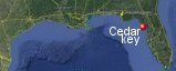
Cedar Key, Florida's History with Tropical Systems

(br) = Brush (ts) = Tropical Storm (bd) = Back Door, meaning coming from over land from opposite coast.
Not all names are noted. Also, storms before 1950 were not named. Not every stat on every storm description is given. (since 1871)

Years within or near core
1871bdts
1871
1872tsbr
1874
1877ts
1879ts
1880tsbr
1880bd
1880
1882
1885ts
1886br
1886
1888
1888tsbd
1889tsbr
1893ts
1896m
1899ts
1900ts
1907tsbr
1909bdts
1919ts
1920ts
1930ts
1932ts
1933bdts
1934tsbd
1935
1940ts
1941ts
1941br
1945
1947ts
1949bd
1950m
1950ts
1953tsbr
1960ts (HURDAT)
1968br
1976subtsbr
1985
1990ts
1995tsbr
1995tsbd
1996tsbr
2000ts
2004tsbr
2004bdts
2006tsbr
2008tsbd
2012ts
2013ts
2016ts
2016br
2017bd
2018mbr
2020ts
2021ts
2022bdtsbr
2022bdts
2023brm
2024br
2024mbr
2024br
65 times in 153 years (as of end of 2024)


Names from list above (E storms most likely to impact the area)
Easy
Gladys
Brenda
Elena
Marco
Allison
Erin
Josephine
Gordon
Frances
Jeanne
Alberto
Fay
Debby
Andrea
Colin
Hermine
Irma
Michael
Eta
Elsa
Ian
Nicole
Idalia
Debby
Helene
Milton
Gladys
Brenda
Elena
Marco
Allison
Erin
Josephine
Gordon
Frances
Jeanne
Alberto
Fay
Debby
Andrea
Colin
Hermine
Irma
Michael
Eta
Elsa
Ian
Nicole
Idalia
Debby
Helene
Milton
Tropical Storm to Hurricane ratio
TS = 42, 64.62%H = 23, 35.38%

Longest gap between storms
17 years 1950-1968How often this area gets affected?
Brushed or hit every 2.35 yearsAverage years between direct hurricane hits. (hurricane force winds for at least a few hours)
Once every 11.77 years. (13 hits) State statsAverage years between major hurricane hits.
Once every 76.5 years. (2 hits)Average MPH of hurricane hits. (based on sustained winds from advisories, not gusts)
88 mphStatistically when this area should be affected next
Before the end of 2027
This is just a statistical average & does not mean the area will be affected by that year.
Last affected by
2024 October 9th Hurricane Milton brushes well to the southeast with 95 mph winds at closest approach while moving east-northeast.This area's hurricane history
- 1871 September 6th a 80 mph cane hits from the southwest
- 1874 September 28th 80 mph
- 1880 back door hurricane regains hurricane strength on August 30th with 80 mph winds moving west-northwest.
- 1880 October 8th 80 mph from the southwest just south
- 1882 October 10th 80 mph just north by 24 miles from the south-southwest.
- 1886 July 18th 75 mph
- 1888 a hurricane kills 9 people here October 10th with 95 mph winds.
- 1896 September 29th 10ft storm surge 100 killed, moving at 46 mph. Tremendous destruction occurred in a 50 mile wide swath from Cedar Key to Savannah. Winds estimated near 125 mph north of Cedar Key. Damage photo | Hit map
- 1935 September 4th (Labor Day Keys hurricane) 3 killed heavy coastal damage winds of 90 mph worst flooding since 1896
- 1945 June 24th 90 mph from the southwest moves in just south of here by 23 miles.
- 1949 August 27th 75 mph just east from the south (HURDAT2)
- 1950 EASY September 5th a storm surge of 5.1 ft with a category 3 at low tide 38 inches of rain areaflooded for several weeks, 120 mph winds (HURDAT) 2/3rds of homes destroyed pressure 28.30 many cars had strange spots on them as a result researches found low barometeric pressure caused air pockets under the paint which later dissapeared. Weather map | Hit map
- 1985 Hurricane Elena with 110 mph winds brushes by to the west by 45 miles while looping in the Gulf causing some coastal flooding here. Hurricane force wind field affected area for several hours before turning away. Cedar Key at 3:30 pm CDT on August 31st had sustained winds of 45 mph, peak gust 60 mph, south wind. Cedar Key had over the road debris of 8+ feet at Route 24 bridge. Richard Horodner Cedar Key | Newspaper article #1 | Newspaper article #2 | Damage survey
- 2017 September 11th, Hurricane Irma begins to weaken to tropical storm but still has 75 mph while impacting the area. Area reported a 2.59 ft storm surge as Irma passed to the east. NHC report | Radar animation (Brian McNoldy, Univ. of Miami, Rosenstiel School)
Please keep these stats free. Donate to HurricaneCity.
.gif)
Stat sources:
Text Sources:
- "Divine Wind" by Kerry Emanuel
- "Florida Hurricanes and Tropical Storms" by John M. Williams and Iver W. Duedall
- "Florida's Hurricane History" by Jay Barnes
- "Hurricane Almanac" by Bryan Norcross
- HurricaneCity.com calculations by Jim Williams
- "Hurricanes and the Middle Atlantic States" by Rick Schwartz
- "Hurricane Watch" by Dr. Bob Sheets and Jack Williams
- "Inside the Hurricane" by Pete Davies
- "Isaac's Storm" by Erik Larson
- "Killer 'Cane" by Robert Mykle
- "Lunatic Wind" by William Price Fox
- Miami Herald newspaper (microfilm)
- "Path of Destruction" by John McQuaid and Mark Schleifstein
- Sun Sentinel newspaper (microfilm)
- "The Major Hurricanes To Affect The Bahamas" by Wayne Neely
- "The Ship and the Storm" by Jim Carrier
- Plus many more......