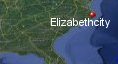
Elizabeth City, North Carolina's History with Tropical Systems

(br) = Brush (ts) = Tropical Storm (bd) = Back Door, meaning coming from over land from opposite coast.
Not all names are noted. Also, storms before 1950 were not named. Not every stat on every storm description is given. (since 1871)

Years within or near core
1876bdts
1877bdts
1878bdts
1879bdm
1881bdbr
1885bdbr
1887xtropstbd
1888bdts
1889bdbr
1892bdts
1893bdts
1893bdbr
1894bd
1897-2ts
1899
1899bdbr
1901
1907xtropst
1908br
1910ts
1918ts
1924xtropstbd
1925ts
1928tsbd
1933
1933br
1935bdts
1936br
1942ts
1944br
1944bdts
1953
1955-2
1956xtropsstbd
1960bdts
1960
1961bdts
1963ts (HURDAT)
1964extropstbd
1971ts
1972bdts
1984ts
1985br
1986ts
1992tsbr
1995xtropbdbr
1996bd
1996bdbr
1996bdxtropstbr
1998tsbdbr
1998xtropstbd
1999
2003
2004bdts
2006xtropstbd
2007tsbd
2008tsbdbr
2011
2013bdxtropst
2014br
2016bdtsbr
2016br
2018br
2018bdts
2019br
2020bdts
2020bdxts
2021-2bdts
2023bdts
72 times in 153 years (as of end of 2024)


Names from list above (A and D storms most likely to impact the area)
Barbara
Connie
Ione
Brenda
Donna
Doria
Agnes
Diana
Gloria
Andrew
Danielle
Allison
Bertha
Fran
Josephine
Bonnie
Floyd
Earl
Isabel
Charley
Hanna
Irene
Andrea
Arthur
Hermine
Matthew
Florence
Michael
Dorian
Isaias
Zeta
Claudette
Elsa
Ophelia
Connie
Ione
Brenda
Donna
Doria
Agnes
Diana
Gloria
Andrew
Danielle
Allison
Bertha
Fran
Josephine
Bonnie
Floyd
Earl
Isabel
Charley
Hanna
Irene
Andrea
Arthur
Hermine
Matthew
Florence
Michael
Dorian
Isaias
Zeta
Claudette
Elsa
Ophelia
Tropical Storm to Hurricane ratio
TS = 44, 61.11%H = 28, 38.89%

Longest gap between storms
11 years 1973-1983How often this area gets affected?
Brushed or hit every 2.13 yearsAverage years between direct hurricane hits. (hurricane force winds for at least a few hours)
Once every 11.77 years. (13 hits) State statsAverage years between direct major hurricane hits. (major hurricane in advisory upon passage)
Not enough data to calculate (1 hit)Average MPH of hurricane hits. (based on sustained winds from advisories, not gusts)
87 mphStatistically when this area should be affected next
Before the end of 2025
This is just a statistical average & does not mean the area will be affected by that year.
Last affected by
2023 September 23rd Tropical Storm Ophelia passes just west with 45 mph winds while moving north.This area's hurricane history
- 1879 August 18th from the south with 115 mph winds moving north
- 1894 A tropical storm regains Hurricane strength with 80 mph winds while pulling away on September 29th
- 1899 August 18th 80 mph from the southeast
- 1901 July 11th from the east category 1 winds 80 mph
- 1933 August 23rd, 85 mph (HURDAT2) moving north-northwest
- 1953 August 13th Hurricane Barbara hits from the south with 80 mph gusts to 90 mph. Weather map
- 1955 Connie a slow moving hurricane with 85 mph winds (HURDAT) weakens as it moves into area on August 12th, Connie causes 7 ft tides & destroyes the beaches. Newspaper headline
- 1955 September 19th, Hurricane Ione weakening with 100 mph (HURDAT) winds while turning northeast.
- 1960 September 12th Hurricane Donna passes by just east while moving north-northeast with 105 mph winds
- 1996 Bertha, July 13th, 75 mph from the south
- 1999 September 16th Hurricane Floyd hits from the south-southwest with 80 mph winds
- 2003 September 18th Hurricane Isabel passes approximately 50 miles to the west while moving north-northwest. Isabel approximately 85 mph at the passage downed many trees & virtually all of Elizabeth city was without power.Scores of downed trees, snapped power lines and at least one death left a testament to the fury of the storm. And some residents might not see power restored for two weeks, officials said. A 25-year-old woman, Angelique Jones, was killed on Carl Drive, a street in the Cape Colony subdivision, when a tree fell on her Honda Passport at about 1:30 p.m. Five injured by flying glass at evacuation shelter here. Richard Horodner Elizabeth city | Radar animation (Brian McNoldy, Univ. of Miami, Rosenstiel School) Newspaper headline | Damage photos | Newspaper article | Hit map | Surge animation | NHC final report | USGS surge info
- 2011 August 27th, Hurricane Irene hits with 80 mph winds while moving north-northeast causing minor damage. Official high wind gust was 74 mph in Elizabeth city with sustained around 50 mph August 27-28th. Irene model history | Our coverage as it happened | Radar animation | NHC final report | USGS surge info
Please keep these stats free. Donate to HurricaneCity.
.gif)
Stat sources:
Text Sources:
- "Divine Wind" by Kerry Emanuel
- "Florida Hurricanes and Tropical Storms" by John M. Williams and Iver W. Duedall
- "Florida's Hurricane History" by Jay Barnes
- "Hurricane Almanac" by Bryan Norcross
- HurricaneCity.com calculations by Jim Williams
- "Hurricanes and the Middle Atlantic States" by Rick Schwartz
- "Hurricane Watch" by Dr. Bob Sheets and Jack Williams
- "Inside the Hurricane" by Pete Davies
- "Isaac's Storm" by Erik Larson
- "Killer 'Cane" by Robert Mykle
- "Lunatic Wind" by William Price Fox
- Miami Herald newspaper (microfilm)
- "Path of Destruction" by John McQuaid and Mark Schleifstein
- Sun Sentinel newspaper (microfilm)
- "The Major Hurricanes To Affect The Bahamas" by Wayne Neely
- "The Ship and the Storm" by Jim Carrier
- Plus many more......