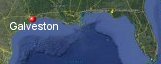
Galveston, Texas' History with Tropical Systems
(br) = Brush (ts) = Tropical Storm (bd) = Back Door, meaning coming from over land from opposite coast.
Not all names are noted. Also, storms before 1950 were not named. Not every stat on every storm description is given. (since 1871)

Years within or near core
1871-2ts
1877br
1879br
1880tsbr
1882tsbr
1886br
1886brm
1888br
1888ts
1891
1895ts
1897br
1898ts
1899ts
1900m
1909
1915m
1932m
1934
1938ts
1940ts
1940br
1941-2ts
1942
1942br
1943
1945m
1947
1949m
1957
1959
1961mbr
1963ts (HURDAT)
1964ts
1970ts
1971-2br
1973ts
1979-2tsbr
1980ts
1982tsbr
1983m
1986br
1987ts
1989br
1989
1995ts
2001ts
2005brm
2007br
2008ts
2008
2017tsbr
2017ts
2020tsbr
2020br
2021ts
2024br
61 times in 153 years (as of end of 2024)


Names from list above (D storms most likely to impact the area)
Audrey
Debra
Carla
Cindy
Abby
Felice
Edith
Fern
Delia
Claudette
Bob
Elena
Danielle
Alicia
Bonnie
Chantal
Jerry
Dean
Allison
Rita
Humberto
Edouard
Ike
Cindy
Harvey
Beta
Delta
Nicholas
Beryl
Debra
Carla
Cindy
Abby
Felice
Edith
Fern
Delia
Claudette
Bob
Elena
Danielle
Alicia
Bonnie
Chantal
Jerry
Dean
Allison
Rita
Humberto
Edouard
Ike
Cindy
Harvey
Beta
Delta
Nicholas
Beryl
Tropical Storm to Hurricane ratio
TS = 28, 47.46%H = 31, 52.54%

Longest gap between storms
16years 1916-1931How often this area gets affected?
Brushed or hit every 2.51 yearsAverage years between direct hurricane hits. (hurricane force winds for at least a few hours)
Once every 9.56 years. (16 hits) State stats (older site)Average years between major hurricane hits.
Once every 30.6 years. (5 hits)Average MPH of hurricane hits. (based on sustained winds from advisories, not gusts)
106 mphStatistically when this area should be affected next
Before the end of 2026
This is just a statistical average & does not mean the area will be affected by that year.
Last affected by
2024 July 8th Hurricane Beryl brushes 51 miles to the west at closest approach with 75 mph winds while moving north-northwest.This area's hurricane history
- 1891 July 6th 80 mph from the south
- 1900 September 8th 145 mph the great galveston hurricane kills 8,000 people with a 15ft storm surge even though it was low tide while hitting it traveled 6 to 10 miles inland from the east-southeast. The pressure at landfall was 27.55 inches with winds of 110 mph.Half of Galveston destroyed with 2,600 buildings destroyed & 10,000 people left homeless would have been much worse if not moving so quickly. It is said that a one inch steel hull of an ocean going freighter was pierced through with a piece of lumber.According to the hurricane research division winds were of Category 4 strength at landfall. Newspaper headline | Max wind map | Monument | Surge animation | Documentary | Interview with Julie Lake summer of the storm | Surge info | Books on the 1900 Galveston hurricane
- 1909 July 21st a 10 ft storm surge with 110 mph winds from the east-southeast 41 killed in texas.
- 1915 August 17th a category 3 120 mph kills 275, 12' tides flooded Galveston 5' to 6' in the Business District. Winds at Galveston were 97 mph gusts to 130 mph putting this in the cat 3/4 range.Press 940 mb,.Seawall prevented a repeat of the 1900 disaster. Causes 50 million in damage. Max wind field
- 1932 August 14th 145 mph winds from the southeast direct hit
- 1934 July 27th, a storm surge of 5.9ft with a category 1, 80 mph that passes just east while moving south
- 1942 August 21st 80 mph from the east-southeast
- 1943 July 27th a storm surge of 4 ft, nineteen killed, 86 mph winds.
- 1945 August 27th 140 mph from the south just west of here
- 1947 August 24th 80 mph from the southeast
- 1949 October 4th 130 mph from the south
- 1957 June 27th 110mph (HURDAT) Hurricane Audrey well east from the south. Newspaper article
- 1959 July 25th Hurricane Debra hit with 85 mph winds, pressure 29.07 inHg, 14.42 inches of rain. NHC Wallet | NWS Graphic
- 1983 Hurricane Alicia on August 18th causes 2 bill damage as a category 2/3 with 71 to 98 mph winds in Galveston moving at a forward speed of 8 mph. 21 killed 1.2 billion dollars in damage, a 10 to 12 foot storm surge at normal high tide. 90% of dwellings on Jamaica Beach destroyed.Many highrise glass buildings sustained heavy damage. Pressure in Galveston was measured at 989 mb 29.20 inches at 2:00AM. From NOAA GPST2 - GALVESTON PLEASURE PIER (PORTS) - TX 29.29 inHg max gust 020/076kts Damage photo | #2 | Max wind field | Dr. Ted Fujita wind map | Newspaper headline | Newspaper headline #2
- 1989 October 15th Jerry 3 dead over 8 million in damage, 85 mph winds.The latest a hurricane ever hit the upper Texas coast NHC Wallet
- 2001 June 5th Tropical Storm Allison hits with 60 mph winds dumping extremely heavy rain especially inland in the Houston area. Over a 120 hr period houston recorded 36.99 inches of rain. Only 3 tropical systems have produced more rain in this area. Tropical Storm Amelia 46.00", Tropical Storm Claudette 45.00", unamed 1921 40.00". 41 deaths related to flooding & 5 billion in damage. Allison was finally retired in July of 2002 as the only tropical storm to be retired. NHC Report
- 2008 Hurricane Ike hits Galveston on September 13th with 110 mph winds causing extensive damage in entire area by 15 ft storm surge.From NOAA GALVESTON G GPST2 11.19 ft storm surge MAJOR 29.29 GALVESTON STATE PLEASURE PIER.A high gust for the Houston area was 92 mph at Hobby airport.Gust at pleasure pier 86 mph.Deaths reported in Texas at 22 with several missing. Hurricane Warning Show | Before & after aerial shot | Bolivar Peninsula just north | Richard Horodner Texas city | Ike model history | SAR Helicopter refueling over Galveston | Newspaper headline | Jim Edds fire video | Newspaper headline 2 days later | Neil Frank describing landfall video | Ike aftermath story video | Surge animation | USGS surge info | Radar animation | NHC Final report
- 2017 August 29th Tropical Storm Harvey just offshore while moving north by 32 miles with 50 mph winds. Galveston Scholes Field (KGLS) 22.87 inches of rain, gusts to 59 mph. Galveston Pier 2.7ft water inundation. Inland counties report upwards of 60inches of rain in some locations most rainfall ever for tropical system in U.S. Radar animation (Brian McNoldy, Univ. of Miami, Rosenstiel School) NHC Final report
Please keep these stats free. Donate to HurricaneCity.
.gif)
Stat sources:
Text Sources:
- "Divine Wind" by Kerry Emanuel
- "Florida Hurricanes and Tropical Storms" by John M. Williams and Iver W. Duedall
- "Florida's Hurricane History" by Jay Barnes
- "Hurricane Almanac" by Bryan Norcross
- HurricaneCity.com calculations by Jim Williams
- "Hurricanes and the Middle Atlantic States" by Rick Schwartz
- "Hurricane Watch" by Dr. Bob Sheets and Jack Williams
- "Inside the Hurricane" by Pete Davies
- "Isaac's Storm" by Erik Larson
- "Killer 'Cane" by Robert Mykle
- "Lunatic Wind" by William Price Fox
- Miami Herald newspaper (microfilm)
- "Path of Destruction" by John McQuaid and Mark Schleifstein
- Sun Sentinel newspaper (microfilm)
- "The Major Hurricanes To Affect The Bahamas" by Wayne Neely
- "The Ship and the Storm" by Jim Carrier
- Plus many more......