Hurricane Betsy (1965)

"About the only consolation you have is when it gets level with your latitude, the chances are pretty slim it will turn back" - Forecaster Raymond Kraft
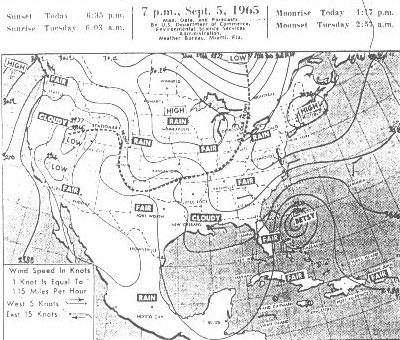
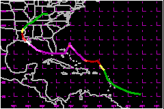
Hurricane Betsy was an erratic hurricane with movement taking her nearly up 30 deg north then abruptly turning south around the southern tip of Florida. Key Largo was hit directly, then the New Orleans area would be next. The death toll reached 75 & when all was said & done, both Florida & Louisiana were very lucky as things could have been much worse. At landfall in South Florida a yacht measured a 6 ft tide in the Miami River. A low pressure barometer graph of that is seen here


Vital statistics as follows, measured gusts via NHC archives:
- Nassau, Bahamas: 126mph, 966mb
- North tip of Andros Island, Bahamas: 126mph
- Abaco Island, Bahamas: 178mph WSW
- Key Largo, Florida hit with 126mph
- Tavernier, Florida gusts to 120mph NW
- Plantation Key, Florida gusts to 100mph, highest on scale
- Big Pine Key, Florida: 125mph SW
- Key West, Florida gusts to 81mph SW
- Miami Beach, Florida gusts to 92mph NNE
- University of Miami: 105mph
- At 28.3N x 89.2W 50 miles southeast of Louisiana coast: 155mph
- Port Sulfur, Louisiana gusts to 136mph
- Grand Isle, Louisiana: 160mph
- New Orleans, Louisiana: 112mph
- Morgan City, Louisiana: 128mph North
- Gulfport, Mississippi: 100mph
- Bay St. Louis, Mississippi: 120mph
- South Florida 6 ft storm surge
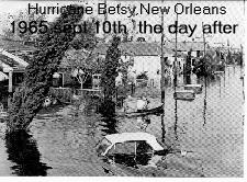
- East Louisiana 8 to 10 ft storm surge
- Lowest Pressure 941mb or 27.79 inHg
- Born as Cape Verde storm August 27th & died September 11th over the southeast US.
- Betsy was attempted to be cloud seeded but the eye was not well enough formed. Scientists were blamed for erratic movement as they were flying research missions into Betsy.