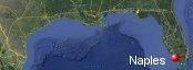
Naples, Florida's History with Tropical Systems

(br) = Brush (ts) = Tropical Storm (bd) = Back Door, meaning coming from over land from opposite coast.
Not all names are noted. Also, storms before 1950 were not named. Not every stat on every storm description is given. (since 1871)

Years within or near core
1873m
1876
1878-2ts
1888bd
1891bdts
1891tsbr
1892ts
1894
1895ts
1896ts
1897ts
1899ts
1903bdtsbr
1904ts
1910m
1916ts
1924
1926bdm
1928ts
1929bd
1932bdts
1934tsbr
1935m
1936-2ts
1941bdm
1944m
1945ts
1945bdm
1946br
1947bd
1948
1950br
1950bdbrm
1951ts
1953
1959tsbr
1960m
1964m
1965bdm
1966m
1968ts
1969ts
1985ts
1990tsbr
1992bdm
1994tsbr
1998bdbr
1998ts
1999ts
2004brm
2005m
2008ts
2017m
2018bdts
2020tsbd
2020tsbr
2021tsbr
2022m
2022bdbr
2024-2mbr
63 times in 153 years (as of end of 2024)


Names from list above
Easy
King
How
Donna
Isbell
Betsy
Alma
Abby
Jenny
Judith
Bob
Marco
Andrew
Gordon
Georges
Mitch
Harvey
Charley
Wilma
Fay
Irma
Gordon
Sally
Eta
Elsa
Ian
Nicole
Helene
Milton
King
How
Donna
Isbell
Betsy
Alma
Abby
Jenny
Judith
Bob
Marco
Andrew
Gordon
Georges
Mitch
Harvey
Charley
Wilma
Fay
Irma
Gordon
Sally
Eta
Elsa
Ian
Nicole
Helene
Milton
Tropical Storm to Hurricane ratio
TS = 32, 50.79%H = 31, 49.21%

Longest gap between storms
15 years 1969-1985How often this area gets affected?
Brushed or hit every 2.43 yearsAverage years between direct hurricane hits. (usually within 40 miles to include small hurricanes)
Once every 6.65 years. (23 hits) State statsAverage years between major hurricane hits.
Once every 10.2 years. (15 hits)Average MPH of hurricane hits. (based on sustained winds from advisories, not gusts)
113 mphStatistically when this area should be affected next
Before the end of 2027
This is just a statistical average & does not mean the area will be affected by that year.
Last affected by
2024 October 9th Hurricane Milton brushes 81 miles to the north-northwest while hitting Sarasota with 120 mph winds while moving east-northeast.This area's hurricane history
- 1873 October 6th a hurricane cause high storm surge with 115 mph winds while moving northeast while hitting Ft Myers. Hit map
- 1876 from south-southwest October 20th 105 mph winds
- 1888 95 mph winds August 17th from the east-southeast.
- 1894 September 25th, 95 mph from the south.
- 1910 pressure 28.40, high storm surge from the south October 18th moved into Naples after hitting Marco Island with 120 mph winds from the south-southwest.
- 1924 October 20th just south from the west-southwest winds here 80 mph press around 29.00 heavy rain up to 24 inches
- 1926 September 18th, 125 mph from the east-southeast
- 1929 September 29th, 95 mph from the east-southeast just south
- 1935 labor day hurricane passes approximately 20 miles to the west after slamming the keys.At time odf passage winds in hurricane were 115 mph September 3rd from the southeast
- 1941 from the east-southeast October 6th, 115 mph
- 1944 October 19th a major hurricane (115mph)brushes just west causing heavy storm surge flooding here from the south.Forecaster Grady Norton called this 2 days out.
- 1945 September 16th a back door Hurricanes brushes just east with 125 mph winds from the southeast
- 1947 a hurricane which pounded the east coast hits here with 100 mph winds while slowly moving west dumping 8 inches of rain & a 6 ft storm surge September 17th.Naples was in the eye for approximately 1 hour.
- 1948 September 21st, 110 mph just southeast from the south-southwest
- 1953 re-analysis project upgrades Hazel to a category 1 with 85 mph winds October 9th landfall to north
- 1960 Hurricane Donna September 10th from the south-southeast a 10 ft storm surge pressure 27.97 120 mph Naples fishing pier destroyed.Winds sustained at over 100 mph with gusts to 130 mph, 12:20 pm. More here | Weather service post sketch | Gordon Dunn talks about forecasting Donna | NHC Wallet
- 1964 Hurricane Isbell hits just south with 125 mph winds. Hit at 4:15 pm October 14th while moving northeast across South Florida. NHC Wallet
- 1965 September 8th, Hurricane Betsy to the south with 120 mph winds from the east
- 1966 Hurricane Alma passes just southwest while moving north with 115 mph on June 8th.
- 1992 August 24th, Andrew from the east 120 mph winds area had some roof damage. Radar animation (Brian McNoldy, Univ. of Miami, Rosenstiel School)
- 2005 October 24th Hurricane Wilma hits from the southwest with 125 mph winds while moving very quickly. Wilma came ashore just south which kept the surge in Naples to a minimum.Naples and East Naples had widespread damage of pool cages and patios two condominium towers in the city that sustained $135 million in damage, Another condominium building, the Stratford of Pelican Bay in North Naples, was also heavily damaged, officials said.The Naples Zoo was heavily damaged and won't open for a month or two, director Larry Tetzlaff said. A Wallaby died from stress while being moved before the storm and some other animals escaped during the hurricane, but were recaptured, he said.No more than 1,000 homes appear to have roof damage. Official final report from NHC 83 mph sustained with gusts to 104 mph. Unofficial Marco Island gust to 134 mph. Radar animation (Brian McNoldy, Univ. of Miami, Rosenstiel School) Wilma satelite picture | Our coverage as it happened | Naples surge photo | Marco Island damage
- 2017 September 10th Hurricane Irma passes directly over while moving north with 115 mph winds. Heavy damage to mobile home communities some roof damage to well built structures. Reported a 5.06 ft storm tide 91 mph sustained gusts to 141 mph. Power outage photos before & after | Best performing models 5 days before hit | UKMET model 2 days out | Long range GEFS many days out | Relief concert 5 former presidents attend | Best track data | USGS surge info | Our live coverage | Radar animation (Brian McNoldy, Univ. of Miami, Rosenstiel School) | Aftermath video tour | NHC report
- 2022 September 28th Hurricane Ian passes just northwest by 37 miles at closest approach with 155 mph winds while moving slowly north-northeast. Naples 115mph+ Northern Naples 127+mph. Several feet of storm surge inundates coastal areas guages measured 6.18 ft. Hit map | Naples wind swath | Radar animation (Brian McNoldy, Univ. of Miami, Rosenstiel School) Our coverage as it happened | NHC Report
Please keep these stats free. Donate to HurricaneCity.
.gif)
Stat sources:
Text Sources:
- "Divine Wind" by Kerry Emanuel
- "Florida Hurricanes and Tropical Storms" by John M. Williams and Iver W. Duedall
- "Florida's Hurricane History" by Jay Barnes
- "Hurricane Almanac" by Bryan Norcross
- HurricaneCity.com calculations by Jim Williams
- "Hurricanes and the Middle Atlantic States" by Rick Schwartz
- "Hurricane Watch" by Dr. Bob Sheets and Jack Williams
- "Inside the Hurricane" by Pete Davies
- "Isaac's Storm" by Erik Larson
- "Killer 'Cane" by Robert Mykle
- "Lunatic Wind" by William Price Fox
- Miami Herald newspaper (microfilm)
- "Path of Destruction" by John McQuaid and Mark Schleifstein
- Sun Sentinel newspaper (microfilm)
- "The Major Hurricanes To Affect The Bahamas" by Wayne Neely
- "The Ship and the Storm" by Jim Carrier
- Plus many more......