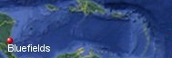
Bluefields, Nicaragua's History with Tropical Systems

(br) = Brush (ts) = Tropical Storm (bd) = Back Door, meaning coming from over land from opposite coast.
Not all names are noted. Also, storms before 1950 were not named. Not every stat on every storm description is given. (since 1871)

Years within or near core
1876
1906m
1908br
1911br
1933ts
1971
1988m
1993-2ts
1996
2005tsbr
2009br
2020brm
2022ts
2022br
1906m
1908br
1911br
1933ts
1971
1988m
1993-2ts
1996
2005tsbr
2009br
2020brm
2022ts
2022br
15 times in 153 years (as of end of 2024)


Names from list above (B storms most likely to impact the area)
Irene
Joan
Bret
Gert
Cesar
Beta
Ida
Iota
Bonnie
Julia
Joan
Bret
Gert
Cesar
Beta
Ida
Iota
Bonnie
Julia
Tropical Storm to Hurricane ratio
TS = 5, 30.77%H = 10, 69.23%

Longest gap between storms
37 years 1933-1971How often this area gets affected?
Brushed or hit every 10.2 yearsAverage years between direct hurricane hits. (hurricane force winds for a few hours)
Once every 30.6 years. (5 hits)Average years between major hurricane hits.
Once every 76.5 years. (2 hits)Average MPH of hurricane hits. (based on sustained winds from advisories, not gusts)
103 mphStatistically when this area should be affected next
2032Last affected by
2022 October 9th Hurricane Julia passes 26 miles to north a brush with 85 mph winds while moving west.This area's hurricane history
- 1876 October 3rd 105 mph winds from due east, reports of destruction
- In 1906 October 10th, a category 3 120 mph hurricane from the east-southeast causes a 15 ft tidlewave pressure 28.57
- 1971 September 19th Irene hits Nicaragua just south of Bluefields from the east September 19th with 75 mph winds, then moved into the Pacific.
- 1988 October 22nd, Hurricane Joan hits from the east with 135 mph winds pressure 27.46 destroys the area & kills 148 in Nicaragua 1 billion dollars damage in Nicaragua. NHC Wallet
- 1996 July 8th, Hurricane Cesar with 80 mph winds hits from the east with a press of 29.21 dumps heavy rain 50 killed. NHC report
Please keep these stats free. Donate to HurricaneCity.
.gif)
Stat sources:
Text Sources:
- "Divine Wind" by Kerry Emanuel
- "Florida Hurricanes and Tropical Storms" by John M. Williams and Iver W. Duedall
- "Florida's Hurricane History" by Jay Barnes
- "Hurricane Almanac" by Bryan Norcross
- HurricaneCity.com calculations by Jim Williams
- "Hurricanes and the Middle Atlantic States" by Rick Schwartz
- "Hurricane Watch" by Dr. Bob Sheets and Jack Williams
- "Inside the Hurricane" by Pete Davies
- "Isaac's Storm" by Erik Larson
- "Killer 'Cane" by Robert Mykle
- "Lunatic Wind" by William Price Fox
- Miami Herald newspaper (microfilm)
- "Path of Destruction" by John McQuaid and Mark Schleifstein
- Sun Sentinel newspaper (microfilm)
- "The Major Hurricanes To Affect The Bahamas" by Wayne Neely
- "The Ship and the Storm" by Jim Carrier
- Plus many more......