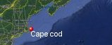
Cape Cod, Massachusetts' History with Tropical Systems
(br) = Brush (ts) = Tropical Storm (bd) = Back Door, meaning coming from over land from opposite coast.
Not all names are noted. Also, storms before 1950 were not named. Not every stat on every storm description is given. (since 1871)

Years within or near core
1871tsbr
1872bdts
1874bdtsbr
1875tsbr
1877xtropstbd
1878bdxtropstbr
1879
1880extratropst
1881tsbr
1882tsbr
1885
1887xtropst
1888tsbd
1888xtropst
1888
1888xtroph
1889ts
1891xtropstbr
1894bdtsbr
1896
1897ts
1902xtropst
1904xtroph
1907xtropst
1913xtropstbr
1916
1923ts
1924
1927
1932xtropst
1934xtropstbd
1936
1938xtropst
1940br
1944
1944xtropst
1952xtropst
1953br
1954
1955bdts
1958br
1959ts
1960br
1961
1962
1966xtropst
1969
1971tsbr
1972tsbr
1991
1996xtropst
1999ts
2004tsbd
2004ts
2006ts
2008tsbd
2011tsbr
2013bdxtropst
2014br
2017tsbr
2019br
2019subtsbr
2021xts
2021tsbr
2023br
65 times in 153 years (as of end of 2024)


Names from list above (B storms most likely to impact the area)
Barbara
Edna
Daisy
Diane
Donna
Cindy
Esther
Alma
Alma
Carrie
Gerda
Bob
Gerda
Doria
Heidi
Belle
Bob
Bertha
Floyd
Josephine
Charley
Hermine
Beryl
Hanna
Irene
Andrea
Arthur
Jose
Dorian
Melissa
Elsa
Henri
Lee
Edna
Daisy
Diane
Donna
Cindy
Esther
Alma
Alma
Carrie
Gerda
Bob
Gerda
Doria
Heidi
Belle
Bob
Bertha
Floyd
Josephine
Charley
Hermine
Beryl
Hanna
Irene
Andrea
Arthur
Jose
Dorian
Melissa
Elsa
Henri
Lee
Tropical Storm to Hurricane ratio
TS = 42, 64.62%H = 23, 35.38%

Longest gap between storms
18 years 1973-1990How often this area gets affected?
Brushed or hit every 2.35 yearsAverage years between direct hurricane hits. (hurricane force winds for at least a few hours)
Once every 9.56 years. (16 hits)Average years between major hurricane hits.
Once every 76.5 years. (2 hits)Average MPH of hurricane hits. (based on sustained winds from advisories, not gusts)
93 mphStatistically when this area should be affected next
Before the end of 2025
This is just a statistical average & does not mean the area will be affected by that year.
Last affected by
2023 September 16th Hurricane Lee passes well east with 80 mph winds while moving north expanding in size giving the area tropical storm force winds area has gusts to 54 mph.This area's hurricane history
- 1879 August 19th eye passes over 80 mph
- 1885 September 23rd, 90 mph just east from the south-southwest
- 1888 September 27th, 80 mph just east from the south-southwest
- 1888 November 27th, 90 mph just east
- 1896 September 10th, 80 mph from the south-southeast
- 1904 September 15th, extratropical hurricane hits from the southwest with 85 mph winds
- 1916 July 21st, 85 mph from the south
- 1924 August 26th 90 mph from the southwest
- 1927 August 24th, 105 mph just east from the southwest
- 1936 September 19th 90 mph from the west-southwest
- 1944 80 mph winds from the south-southwest September 15th pressure 28.34
- 1954 Hurricane Edna hits with 115 mph winds (HURDAT) on September 11th from the south-southwest. Edna video
- 1961 September 21st major Hurricane being downgraded to T.S Esther loops just south with 120 mph down to 70 mph while passing by, this Hurricane was earlier cloud seeded. NHC Wallet
- 1962 August 29th Hurricane Alma passes to the east with 90 mph from the southwest NHC Wallet
- 1969 September 9th, Hurricane Gerda passes just east with 120 mph winds from the southwest. NHC Wallet
- 1991 Hurricane Bob hits just west with 110 mph winds from the south-southwest, 5 associated Tornadoes pressure 28.45 August 19th Newspaper article | Satellite image | News video
Please keep these stats free. Donate to HurricaneCity.
.gif)
Stat sources:
Text Sources:
- "Divine Wind" by Kerry Emanuel
- "Florida Hurricanes and Tropical Storms" by John M. Williams and Iver W. Duedall
- "Florida's Hurricane History" by Jay Barnes
- "Hurricane Almanac" by Bryan Norcross
- HurricaneCity.com calculations by Jim Williams
- "Hurricanes and the Middle Atlantic States" by Rick Schwartz
- "Hurricane Watch" by Dr. Bob Sheets and Jack Williams
- "Inside the Hurricane" by Pete Davies
- "Isaac's Storm" by Erik Larson
- "Killer 'Cane" by Robert Mykle
- "Lunatic Wind" by William Price Fox
- Miami Herald newspaper (microfilm)
- "Path of Destruction" by John McQuaid and Mark Schleifstein
- Sun Sentinel newspaper (microfilm)
- "The Major Hurricanes To Affect The Bahamas" by Wayne Neely
- "The Ship and the Storm" by Jim Carrier
- Plus many more......