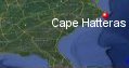
Cape Hatteras, North Carolina's History with Tropical Systems

(br) = Brush (ts) = Tropical Storm (bd) = Back Door, meaning coming from over land from opposite coast.
Not all names are noted. Also, storms before 1950 were not named. Not every stat on every storm description is given. (since 1871)

Years within or near core
1871tsbr
1874bdtsbr
1875tsbr
1877tsbr
1878br
1878bdbr
1879m
1879tsbr
1880
1881bdtsbr
1882tsbr
1882br
1885
1885br
1887-2m
1887ts
1888tsbr
1888ts
1888br
1889ts
1893bdtsbr
1893tsbd
1893-2ts
1894ts
1894tsbr
1897-3ts
1899m
1900xtropst
1901br
1903br
1907xtropst
1908
1908ts
1910xtropst
1910ts
1912xtropstbd
1913br
1918ts
1924m
1924xtropstbd
1925xtropts
1930br
1933-2
1934xtroph
1936
1937ts
1937tsbr
1938xtropst
1940br
1944m
1945ts
1946bdts
1949
1950m
1951
1951br
1953
1954
1954m
1955-2
1958br
1958m
1960
1962
1963ts
1964-2bdts
1964xtropst
1968
1969br
1971tsbr
1971br
1972bdts
1972tsbr
1975tsbr
1976br
1981bdts
1982subtr
1984ts
1985
1986
1991m
1992ts
1993m
1995xtropstbd
1996bdbr
1996xtropstbd
1998ts
1999-2br
1999
2002ts
2003
2004
2005
2007ts
2010br
2011
2014
2016bdts
2016br
2017br
2018br
2018bdtsbr
2019
2020tsbr
2020bdtsbr
2021tsbd
2021ts
2022bdtsbr
2023bdtsbr
2023tsbr
2025br not in stats
118 times in 153 years (as of end of 2024)


Names from list above (D storms most likely to impact the area)
Able
Able (again)
How
Barbara
Carol
Edna
Connie
Ione
Daisy
Helene
Donna
Alma
Ginny
Cleo
Dora
Isbell
Gladys
Gerda
Dawn
Hallie
Agnes
Doria
Ginger
Belle
Dennis
Diana
Gloria
Charley
Bob
Danielle
Emily
Allison
Bertha
Josephine
Bonnie
Dennis
Floyd
Irene
Gustav
Isabel
Alex
Ophelia
Gabrielle
Earl
Irene
Arthur
Hermine
Matthew
Maria
Florence
Michael
Dorian
Arthur
Isaias
Claudette
Elsa
Ian
Idalia
Ophelia
Erin
Tropical Storm to Hurricane ratio
TS = 60, 50.85%H = 58, 49.15%

Longest gap between storms
5 years 1919-1923How often this area gets affected?
Brushed or hit every 1.30 yearsAverage years between direct hurricane hits. (hurricane force winds for at least a few hours)
Once every 4.25 years. (36 hits) State statsAverage years between direct major hurricane hits. (major hurricane in advisory upon passage)
Once every 15.30 years. (10 hits)Average MPH of hurricane hits. (based on sustained winds from advisories, not gusts)
99 mphStatistically when this area should be affected next
Brushed in 2025
This is just a statistical average & does not mean the area will be affected by that year.
Last affected by
2025 Aug 21st hurricane Erin brushed well to the East with 105mph winds at closest approach.This area's hurricane history
- 1879 August 18th 115 mph from the south
- 1880 September 9th back door hurricane 80 mph from the southwest
- 1885 August 26th 80 mph from the west-southwest.
- 1887 August 20th, 120 mph just east from the southwest. Hit map
- 1887 August 24th, 125 mph from the southwest passes 46 miles to east. Hit map
- 1899 August 17th 120 mph from the southeast Cape Hatteras experienced 93 mph winds with gusts of 120 to 140 mph before the anemometer blew away. The island was covered by 4 to 10 feet of water.25 deaths reported in North Carolina pressure 28.62 inches at 8:00 pm ET. Numerous ships sunk offshore weather map
- 1908 May 29th, 75 mph from the south-southwest
- 1924 August 25th, 125 mph just east from the south-southwest
- 1933 August 23rd, 80 mph from the east-southeast
- 1933 on September 16th, 90 mph from the south-southeast 21 killed from a hurricane causing major damage, high storm surge in Pamlico & Albermarle sounds due to gusts of 125 mph.Pressure 28.25 with 13 inches of rain reported.
- 1934 September 8th extratropical hurricane hits just east with 80 mph winds
- 1936 September 18th, 105 mph from the southeast
- 1944 September 14th a hurricane hits with 115 mph from the south, pressure 27.97, 390 lost at sea.
- 1949 August 24th, 110 mph from the south-southwest passes just east
- 1950 August 20th Hurricane Able passes just east from the south-southwest with 125 mph winds
- 1951 May 21st Hurricane Able just east with 75 mph winds (HURDAT2) from the south-southwest
- 1953 August 13th Hurricane Barbara 95 mph from the south gusts to 100 mph, some roof damage as she turned northeast & headed out to sea.| Weather map
- 1954 Hurricane Carol from the south-southwest 90mph (HURDAT) August 30th gusts to 90 & 100 mph while brushing just east by 30 miles. Huge waves tear up fishing piers.Only a few houses unroofed
- 1954 September 10th Hurricane Edna passes just east from the south-southwest with 125 mph winds
- 1955 August 12th Hurricane Connie 95 mph (HURDAT) from the south just west Newspaper headline
- 1955 September 19 Hurricane Ione from the south passes just west with 100 mph winds (HURDAT)
- 1958 September 27th Hurricane Helene just south with 125 mph winds while moving northeast. Sustained north-northeast @ 69 mph, 9:55 pm, peak gust 106 mph north, 4.85 inches of rain. NHC notes
- 1960 September 12th Hurricane Donna passes just west of here from the south-southwest with 105 mph winds causing moderate damage. More here
- 1962 Hurricane Alma August 28th 75 mph winds from the southwest just south & east
- 1968 October 20th Hurricane Gladys 80 mph from the southwest passes just east.
- 1985 September 27th Hurricane Gloria passes over with with 105 mph winds from the south,. Pressure 27.98 winds reported at 6 mph as eye passes over. Newspaper headline | More on Hurricane Gloria here | Michael Laca cedar island
- 1986 August 17th, Hurricane Charley 75 mph from the south
- 1991 August 18th Hurricane Bob passes just east with 115 mph winds from the south-southwest
- 1993 Hurricane Emily hits September 1st with 115 mph winds from the south before turing east-northeast for a short period of time causing some roof damage. Richard Horodner in Cape Hatteras
- 1999 Hurricane Floyd September 16th, 95 mph from the south-southwest just west
- 2003 September 18th Hurricane Isabel hits with 100 mph winds from the south-southeast causing moderate damage. Maximum 1 minute wind 105 mph Moving northwest @24 mph some roof damage, some coastal homes destroyed. 1,700 ft wide channel cut into Pamlico sound.10 ft storm surge observed in the Neuse river.-6 to 8 ft in upper Chesapeake river. Radar animation (Brian McNoldy, Univ. of Miami, Rosenstiel School) damage photos | Newspaper article | USGS surge info | Hit map
- 2004 August 3rd Hurricane Alex hits with 100 mph winds from the south-southwest on the way out to sea, causing heavy flooding around sounds.West eyewall on Cape hatteras with most category 2 winds remaining offshore. Pressure 28.70 inHg. Hundreds of cars flooded due to quick rising surge.Unofficial peak gust was 102 mph in hatteras village. A gust to 87 mph recorded in Avon before instrument failed.6 to 8 inches of rain in most areas.Damage estimated less than 5 million.
- 2005 September 15th Hurricane Ophelia hits just south with 80 mph winds before moving out to sea from the southwest. Radar animation (Brian McNoldy, Univ. of Miami, Rosenstiel School)
- 2011 August 27th, Hurricane Irene hits from the south with 85 mph winds. Hatteras Island was not accessible due to multiple areas of overwash on Hwy 12 north of Rodanthe. The town of Duck not accessible because of impassable roads. 280,000 in eastern Carolina without power.The hurricane forced waters up into the Currituck and Albemarle sounds and when winds shifted, the pent-up waters came rushing back toward the south.Post storm surveys indicate a surge of 8 to 11 ft occured in portions of Pamlico Sound. The highest surge was reported at Oregon Inlet 7.09ft. There was widespread flooding of buildings on both sides of Roanoke Island including Wanchese and Manteo. Many homes flooded on the soundside of the beach towns and in Dare County's unincorporated areas including East Lake, Stumpy Point, Colington Harbor and Manns Harbor, all of which report major damage. Official high wind gust at uscg station 79 mph sustained 60 mph Hurricane Warning Show | Irene model history | Radar animation | USGS surge info
- 2014 July 4th Hurricane Arthur hits while moving northeast with 100 mph winds. Highway 12 road was submerged under several feet of water Friday morning with some road buckled. As of Friday morning, more than 41,000 customers in North Carolina were without power but overall minor damage.Official surge of 2.6ft measured on Cape Hatteras sound side.Sixteen structures major damage, 145 minor damage.Minimum pressure of 988.1 mb measured at coast guard station. NHC final report | HurricaneCity.com live broadcast as it happened
- 2019 September 6th Hurricane Dorian eye passes over while Dorian was moving northeast with 95 mph winds 959.7 mb. Area had gusts to 100 mph and 110 mph at Cedar Isl Ferry Terminal. 5.55 ft above normal tide levels at a NOAA National Ocean Service gauge at the U.S. Coast Guard Station Hatteras on the Pamlico Sound side of the Outer Banks. (per NHC report) Radar animation (Brian McNoldy, Univ. of Miami, Rosenstiel School) NHC report
Please keep these stats free. Donate to HurricaneCity.
.gif)
Stat sources:
Text Sources:
- "Divine Wind" by Kerry Emanuel
- "Florida Hurricanes and Tropical Storms" by John M. Williams and Iver W. Duedall
- "Florida's Hurricane History" by Jay Barnes
- "Hurricane Almanac" by Bryan Norcross
- HurricaneCity.com calculations by Jim Williams
- "Hurricanes and the Middle Atlantic States" by Rick Schwartz
- "Hurricane Watch" by Dr. Bob Sheets and Jack Williams
- "Inside the Hurricane" by Pete Davies
- "Isaac's Storm" by Erik Larson
- "Killer 'Cane" by Robert Mykle
- "Lunatic Wind" by William Price Fox
- Miami Herald newspaper (microfilm)
- "Path of Destruction" by John McQuaid and Mark Schleifstein
- Sun Sentinel newspaper (microfilm)
- "The Major Hurricanes To Affect The Bahamas" by Wayne Neely
- "The Ship and the Storm" by Jim Carrier
- Plus many more......