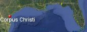
Corpus Christi, Texas' History with Tropical Systems

(br) = Brush (ts) = Tropical Storm (bd) = Back Door, meaning coming from over land from opposite coast.
Not all names are noted. Also, storms before 1950 were not named. Not every stat on every storm description is given. (since 1871)

Years within or near core
1874bdts
1875m
1881ts
1886m
1886bd
1902ts
1912
1913
1916
1919
1921tsbr
1929br
1931tsbr
1934ts
1936ts
1942br
1943-2tsbr
1945m
1945tsbr
1958ts
1960tsbr
1961m
1967bdbr
1968ts
1970m
1971ts
1980brm
1993ts
1998ts
1999brm
2003br
2007ts
2010tsbr
2017m
2020br
2023ts
1875m
1881ts
1886m
1886bd
1902ts
1912
1913
1916
1919
1921tsbr
1929br
1931tsbr
1934ts
1936ts
1942br
1943-2tsbr
1945m
1945tsbr
1958ts
1960tsbr
1961m
1967bdbr
1968ts
1970m
1971ts
1980brm
1993ts
1998ts
1999brm
2003br
2007ts
2010tsbr
2017m
2020br
2023ts
37 times in 153 years (as of end of 2024)


Names from list above (C storms most likely to impact the area)
Ella
Carla
Cindy
Celia
Fern
Arlene
Charley
Bret
Claudette
Erin
Hermine
Harvey
Hanna
Harold
Carla
Cindy
Celia
Fern
Arlene
Charley
Bret
Claudette
Erin
Hermine
Harvey
Hanna
Harold
Tropical Storm to Hurricane ratio
TS = 19, 51.35%H = 18, 48.65%

Longest gap between storms
15 years 1887-1901How often this area gets affected?
Brushed or hit every 4.14 yearsAverage years between direct hurricane hits. (hurricane force winds for at least a few hours)
Once every 13.91 years. (11 hits) State stats (older site)Average years between major hurricane hits.
Once every 25.5 years. (6 hits)Average MPH of hurricane hits. (based on sustained winds from advisories, not gusts)
112 mphStatistically when this area should be affected next
Before the end of 2028
This is just a statistical average & does not mean the area will be affected by that year.
Last affected by
2023 Tropical Storm Harold hits just south August 22nd with 60 mph winds while moving west. Area had 1 to 3 ft storm surge, gusts to 65 mph over 4" of rain per NHC.This area's hurricane history
- 1875 a hurricane hits with 115 mph winds just north September 16th 150 killed in texas. Hit map
- 1886 August 20th a hurricane from the east-southeast with 150 mph winds passes just north. Hit map
- 1886 September 23rd 80 mph from the south
- 1912 -95 mph October 16th from the south-southeast
- 1913 from the southeast June 27th category 1 75 mph from the east-southeast
- 1916 August 19th hits pressure 29.07 90 mph 15 killed
- 1919 85 mph from the east on September 14th a 16 ft storm surge kills 284 pressure 28.65, 900 homes destroyed. 488 missing at sea off the Florida coast
- 1945 August 26th 130 mph while moving by to the north just offshore a 4 foot storm surge.
- 1961 Hurricane Carla comes in just north of here by 50 miles with 145 mph winds (HURDAT) on September 11th. NHC Wallet
- 1970 August 3rd, 140 mph, 944 mb. (reanalysis) From the east-southeast Hurricane Celia hits as area has gusts to 161 mph, kills 15, injures 466 causes 1.8 billion dollars damage (in 1998 figures) total devastation. 65,000 families suffered loses in Texas, 8,950 homes destroyed, 13,850 severly damaged, 41,800 minor damage. Best track data | Satellite at landfall | NHC tide report | Celia video as it happened
- 2017 August 25th/26th Hurricane Harvey hits just north of city by 23 miles with 130 mph winds while moving northwest caused heavy damage to small towns to north. Corpus Christi Naval Air Station recorded 986 mb with gust to 87 mph. Port Aransas just north 93 mph gust to 124 mph, Rockport gust to 108 mph, Port Aransas Sentinel gust to 130 mph. DOW recorded gust to 144 mph in Rockport. Deaths 68 in Texas but none in this area mostly areas to north due to heavy rainfall and flooding. Radar at landfall | NHC advisory wind swath | Our live broadcast as it happened | Relief concert 5 former presidents attend | Texas sea grant paper | Houston NWS Harvey info | HC best track data | NHC Final report | USGS surge info
Please keep these stats free. Donate to HurricaneCity.
.gif)
Stat sources:
Text Sources:
- "Divine Wind" by Kerry Emanuel
- "Florida Hurricanes and Tropical Storms" by John M. Williams and Iver W. Duedall
- "Florida's Hurricane History" by Jay Barnes
- "Hurricane Almanac" by Bryan Norcross
- HurricaneCity.com calculations by Jim Williams
- "Hurricanes and the Middle Atlantic States" by Rick Schwartz
- "Hurricane Watch" by Dr. Bob Sheets and Jack Williams
- "Inside the Hurricane" by Pete Davies
- "Isaac's Storm" by Erik Larson
- "Killer 'Cane" by Robert Mykle
- "Lunatic Wind" by William Price Fox
- Miami Herald newspaper (microfilm)
- "Path of Destruction" by John McQuaid and Mark Schleifstein
- Sun Sentinel newspaper (microfilm)
- "The Major Hurricanes To Affect The Bahamas" by Wayne Neely
- "The Ship and the Storm" by Jim Carrier
- Plus many more......