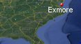
Exmore, Virginia's History with Tropical Systems

(br) = Brush (ts) = Tropical Storm (bd) = Back Door, meaning coming from over land from opposite coast.
Not all names are noted. Also, storms before 1950 were not named. Not every stat on every storm description is given. (since 1871)

Years within or near core
1872bdts
1874bdts
1877bdxts
1878bdbr
1879
1880br
1881bdts
1882-2bdts
1886bdts
1888-2bdts
1889bdts
1893bdtsbr
1893br
1893ts
1893bdbr
1894br
1894bd
1897-2tsbr
1899br
1899bdtsbr
1901br
1902bdxts
1903br
1904bdts
1916bdxts
1933
1933br
1935bdbr
1936
1944br
1944bdxts
1953br
1954br
1955
1955bdbr
1959bdts
1960bdts
1960
1961bdts
1967ts
1971bdts
1976br
1981ts
1983ts
1985
1986br
1992ts
1996bdts
1999
2003br
2004bdts
2008bdts
2011
2012
2013bdxts
2018bdts
2019br
2020bdts
2020bdxts
2021bdts
2023bdtsbr
64 times in 153 years (as of end of 2024)


Names from list above (D storms most likely to impact the area)
Barbara
Carol
Connie
Ione
Cindy
Brenda
Donna
Doria(67)
Doria(71)
Belle
Bret
Dean
Gloria
Charley
Danielle
Bertha
Floyd
Isabel
Charley
Hanna
Irene
Sandy
Andrea
Michael
Dorian
Isaias
Zeta
Elsa
Ophelia
Carol
Connie
Ione
Cindy
Brenda
Donna
Doria(67)
Doria(71)
Belle
Bret
Dean
Gloria
Charley
Danielle
Bertha
Floyd
Isabel
Charley
Hanna
Irene
Sandy
Andrea
Michael
Dorian
Isaias
Zeta
Elsa
Ophelia
Tropical Storm to Hurricane ratio
TS = 36, 56.25%H = 28, 43.75%

Longest gap between storms
16 years 1917-1932How often this area gets affected?
Brushed or hit every 2.39 yearsAverage years between direct hurricane hits. (hurricane force wind gusts for a few hours)
Once every 17 years. (9 hits)Average MPH of hurricane hits. (based on sustained winds from advisories, not gusts)
90 mphStatistically when this area should be affected next
Before the end of 2026
This is just a statistical average & does not mean the area will be affected by that year.
Last affected by
2023 September 23rd Tropical Storm Ophelia passes southwest with 45 mph winds while becoming post tropical.This area's hurricane history
- 1879 August 18th A hurricane with 105 mph winds passes just 25 miles east while moving north-northeast.
- 1933 August 23rd from the southeast just south with 75 mph winds.
- 1936 September 18th a hurricane approaches from the southeast then turns northeast away closest approach 44 miles with 100 mph winds.
- 1955 Hurricane Connie weakens to a tropical storm with 75 mph winds on August 13th from the south.
- 1960 Hurricane Donna passes just east by 49 miles on September 12th with 110 mph winds headed towards New England.
- 1985 Hurricane Gloria passes just east by 48 miles on September 27th while moving north with 100 mph winds.
- 1999 Hurricane Floyd hits from the south with 75 mph winds on September 16th.
- 2011 Hurricane Irene hits from the south just 25 miles east while moving north with 80 mph winds on August 27th. Radar animation (Brian McNoldy, Univ. of Miami, Rosenstiel School) Hurricane Warning Show | USGS surge info
- 2012 Hurricane Sandy passes just north by 100 miles but the large hurricane force wind field of 90 mph expands while moving onshore October 29th. Radar animation (Brian McNoldy, Univ. of Miami, Rosenstiel School) USGS surge info
Please keep these stats free. Donate to HurricaneCity.
.gif)
Stat sources:
Text Sources:
- "Divine Wind" by Kerry Emanuel
- "Florida Hurricanes and Tropical Storms" by John M. Williams and Iver W. Duedall
- "Florida's Hurricane History" by Jay Barnes
- "Hurricane Almanac" by Bryan Norcross
- HurricaneCity.com calculations by Jim Williams
- "Hurricanes and the Middle Atlantic States" by Rick Schwartz
- "Hurricane Watch" by Dr. Bob Sheets and Jack Williams
- "Inside the Hurricane" by Pete Davies
- "Isaac's Storm" by Erik Larson
- "Killer 'Cane" by Robert Mykle
- "Lunatic Wind" by William Price Fox
- Miami Herald newspaper (microfilm)
- "Path of Destruction" by John McQuaid and Mark Schleifstein
- Sun Sentinel newspaper (microfilm)
- "The Major Hurricanes To Affect The Bahamas" by Wayne Neely
- "The Ship and the Storm" by Jim Carrier
- Plus many more......