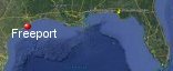
Freeport, Texas' History with Tropical Systems

(br) = Brush (ts) = Tropical Storm (bd) = Back Door, meaning coming from over land from opposite coast.
Not all names are noted. Also, storms before 1950 were not named. Not every stat on every storm description is given. (since 1871)

Years within or near core
1871-2ts
1874tsbr
1877br
1879br
1880ts
1886br
1888
1888ts
1891
1895ts
1898tsbr
1899ts
1900m
1901tsbr
1909
1915m
1921br
1929br
1932
1933ts
1934br
1934
1938ts
1940ts
1941
1942-2br
1943br
1945tsbr
1945m
1947
1949m
1957brm
1959
1961brm
1964ts
1970tsbr
1970brm
1971br
1973ts
1979ts
1980tsbr
1983m
1989ts
1989
1995ts
2001ts
2002ts
2003br
2007tsbr
2008
2017bdts
2020ts
2020br
2021
2024
57 times in 153 years (as of end of 2024)


Names from list above
Carla
Abbey
Felice
Celia
Fern
Delia
Elena
Jerry
Dean
Allison
Fay
Claudette
Humberto
Ike
Harvey
Beta
Delta
Nicholas
Beryl
Abbey
Felice
Celia
Fern
Delia
Elena
Jerry
Dean
Allison
Fay
Claudette
Humberto
Ike
Harvey
Beta
Delta
Nicholas
Beryl
Tropical Storm to Hurricane ratio
TS = 25, 43.86%H = 32, 56.14%

Longest gap between storms
7 years 1902-1908 & 1922-1928How often this area gets affected?
Brushed or hit every 2.68 yearsAverage years between direct hurricane hits. (hurricane force winds for at least a few hours)
Once every 9 years. (17 hits) State stats (older site)Average years between major hurricane hits.
Once every 30.6 years. (5 hits)Average MPH of hurricane hits. (based on sustained winds from advisories, not gusts)
99 mphStatistically when this area should be affected next
Before the end of 2027
This is just a statistical average & does not mean the area will be affected by that year.
Last affected by
2024 July 8th Hurricane Beryl hits while pssing just northwest with 80 mph winds.This area's hurricane history
- 1888 June 17th 80 mph from the east-southeast
- 1891 July 6th 80 mph from the south
- 1900 September 9th 145 mph from the east-southeast
- 1909 a hurricane with 95 mph winds brushes just north killing 41 in texas, July 21st pressure 28.99.
- 1915 August 17th a major hurricane with 120 mph winds hits from the southeast causing a 10ft storm surge. Max wind field
- 1932 August 14th 40 killed pressure 27.83 100 mph
- 1934 August 27th 80 mph from the north-northeast just offshore
- 1941 September 23rd 90 mph weakening to T-storm from the south. Tide 9.9ft, 958mb, 4 killed.
- 1945 August 27th 140 mph winds from the south
- 1947 August 24th 80 mph winds from the southeast
- 1949 October 4th a storm surge of 10.4 ft with a category 3 hurricane 115 mph (HURDAT), gusts to 135 mph, most damage to crops from the south.
- 1959 July 24th 85mph (HURDAT) from the south Hurricane Debra in July pressure 29.07. Winds gusted to 105 mph near Freeport. Hurricane force winds were experienced 100 miles inland. Storm surge 8 ft over 14" of rain. NHC Wallet
- 1983 Hurricane Alicia comes ashore just north of here with 115 mph winds causing heavy damage on August 18th. Dr Ted Fujita wind map | NHC Wallet
- 1989 October 16th Hurricane Jerry hits with 85 mph from the south. NHC Wallet
- 2008 Hurricane Ike hits Galveston approximately 35 miles to the north on September 13th with 110 mph winds but this large systems Hurricane force winds extended down to Freeport causing extensive damage to some homes.From NOAA FPPT2 - FREEPORT (PORTS) - TX 28.95 max gust 330/076kts. Radar animation (Brian McNoldy, Univ. of Miami, Rosenstiel School) Hurricane Warning Show | Surfside flooding just north | Ike model history | USGS surge info
- 2021 September 14th Hurricane Nicolas makes landfall just south by 20 miles with 75 mph winds while moving north. At Freeport Harbor, a TCOON station reported a sustained wind of 57 kt and a gust to 74 kt. Radar animation (Brian McNoldy, Univ. of Miami, Rosenstiel School) hit map | NHC Report
- 2024 July 8th Hurricane Beryl hits while pssing just northwest with 80 mph winds. Radar animation (Brian McNoldy, Univ. of Miami, Rosenstiel School. Recon data right before landfall.
Please keep these stats free. Donate to HurricaneCity.
.gif)
Stat sources:
Text Sources:
- "Divine Wind" by Kerry Emanuel
- "Florida Hurricanes and Tropical Storms" by John M. Williams and Iver W. Duedall
- "Florida's Hurricane History" by Jay Barnes
- "Hurricane Almanac" by Bryan Norcross
- HurricaneCity.com calculations by Jim Williams
- "Hurricanes and the Middle Atlantic States" by Rick Schwartz
- "Hurricane Watch" by Dr. Bob Sheets and Jack Williams
- "Inside the Hurricane" by Pete Davies
- "Isaac's Storm" by Erik Larson
- "Killer 'Cane" by Robert Mykle
- "Lunatic Wind" by William Price Fox
- Miami Herald newspaper (microfilm)
- "Path of Destruction" by John McQuaid and Mark Schleifstein
- Sun Sentinel newspaper (microfilm)
- "The Major Hurricanes To Affect The Bahamas" by Wayne Neely
- "The Ship and the Storm" by Jim Carrier
- Plus many more......