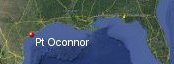
Port O'Connor, Texas History with Tropical Systems

(br) = Brush (ts) = Tropical Storm (bd) = Back Door, meaning coming from over land from opposite coast.
Not all names are noted. Also, storms before 1950 were not named. Not every stat on every storm description is given. (since 1871)

Years within 60 miles
1874ts
1875
1877tsbr
1880ts
1881ts
1886tsbr
1886m
1886br
1888br
1888tsbr
1891br
1900brm
1901ts
1902tsbr
1909brm
1912tsbr
1915brm
1921
1929
1932brm
1934
1934br
1936br
1941br
1942
1945tsbr
1945
1949m
1958tsbr
1959br
1961m
1964ts
1968ts
1970m
1971ts
1973ts
1983brm
1998-2ts
2002ts
2003
2007tsbr
2015ts
2017brm
2020ts
2021
2024
47 times in 153 years (as of end of 2024)


Names from list above (C storms most likely to impact the area)
Ella
Debra
Carla
Abby
Candy
Celia
Fern
Bill
Delia
Alicia
Charley
Frances
Fay
Claudette
Erin
Bill
Harvey
Beta
Nicholas
Beryl
Debra
Carla
Abby
Candy
Celia
Fern
Bill
Delia
Alicia
Charley
Frances
Fay
Claudette
Erin
Bill
Harvey
Beta
Nicholas
Beryl
Tropical Storm to Hurricane ratio
TS = 21, 44.68%H = 26, 55.32%

Longest gap between storms
14 years 1984-1997How often this area gets affected?
Brushed or hit every 3.26 yearsAverage years between direct hurricane hits. (hurricane force wind gusts for a few hours)
Once every 11.77 years. (13 hits) State stats (older site)Average years between major hurricane hits.
Once every 38.25 years. (4 hits)Average MPH of hurricane hits. (based on sustained winds from advisories, not gusts)
102 mphStatistically when this area should be affected next
Before the end of 2027
This is just a statistical average & does not mean the area will be affected by that year.
Last affected by
2024 July 8th Hurricane Beryl hits with 80 mph winds while moving northwest.This area's hurricane history
- 1875 September 16 90 mph causes very heavy storm surge flooding from the east-southeast. Three-fourths of the town was swept away...176 lives were lost. The highest wind measured was 88 m.p.h., when the anemometer blew away. Winds were estimated to be near 100 m.p.h. at the storm's peak. The storm surge was estimated near 15 feet.
- 1886 August 20th 150 mph winds just south from the east-southeast.Town of Indianola nearly destroyed when a storm surge of 15 feet inundated the region, covering the base of the Matagorda Island lighthouse with 4 feet of water. Hit map
- 1921 June 22nd an 85 mph hurricane hits from the south, port oconnor reported winds up to 110 mph pressure 929 mb
- 1929 June 28th, 80 mph from the southeast
- 1934 July 25th, 75 mph from the east just south
- 1942 August 30th, 80 mph just north from the southeast.storm surge up 14ft reported in Matagorda.
- 1945 August 27th 110mph (HURDAT) hits just offshore while moving North. Press 28.57 highest gust 135 mph Port oconnor had a 15ft storm surge.Heavy damage 7 killed
- 1949 October 3rd, 130 mph just east from the south
- 1961 September 11th Hurricane carla hits with 145mph (HURDAT) winds from the southeast. Port Oconnor had a 14.5ft storm tide (HURDAT).some gusts in the area were 175 mph 34 killed due to the largest peacetime evacuation for that time.Recon pressure 931 mb as it hit coast. At the time port occonor had a population of 700. Newspaper headline | Radar from T.V | NHC Wallet
- 1970 August 3rd Hurricane Celia hits just south with 140 mph winds 944mb(reanalysis) from the east-southeast. With the worst winds down near Aransas pass & Corpus christi gusts to 175 mph anemometers broke. 4 were killed in this storm & heavy damage was reported. NHC Wallet
- 2003 July 15th Hurricane Claudette hits from the east with 85 mph gusts to 111 mph. Damage to roofs, signs with many trees down. Moderate damage all around Matagorda Bay.Pressure 979 mb or 28.91 at landfall.Texas coastal Ocean Observation network reported 6 min average 62kts with a gust to 72 kts. 3 killed & 180 million in damage. Radar animation (Brian McNoldy, Univ. of Miami, Rosenstiel School) Damage photo | Newspaper article | NHC final report
- 2021 September 13th Hurricane Nicholas passes just east with 75 mph winds while moving north. Per NHC report. A TCOON station at Port O'Connor reported a sustained wind of 56 kt and a gust to 67 kt. Radar animation (Brian McNoldy, Univ. of Miami, Rosenstiel School) NHC Report
- 2024 July 8th Hurricane Beryl hits with 80 mph winds while moving northwest causing extensive damage as the system was strengthening. Radar image at landfall | Recon data right before landfall.
Please keep these stats free. Donate to HurricaneCity.
.gif)
Stat sources:
Text Sources:
- "Divine Wind" by Kerry Emanuel
- "Florida Hurricanes and Tropical Storms" by John M. Williams and Iver W. Duedall
- "Florida's Hurricane History" by Jay Barnes
- "Hurricane Almanac" by Bryan Norcross
- HurricaneCity.com calculations by Jim Williams
- "Hurricanes and the Middle Atlantic States" by Rick Schwartz
- "Hurricane Watch" by Dr. Bob Sheets and Jack Williams
- "Inside the Hurricane" by Pete Davies
- "Isaac's Storm" by Erik Larson
- "Killer 'Cane" by Robert Mykle
- "Lunatic Wind" by William Price Fox
- Miami Herald newspaper (microfilm)
- "Path of Destruction" by John McQuaid and Mark Schleifstein
- Sun Sentinel newspaper (microfilm)
- "The Major Hurricanes To Affect The Bahamas" by Wayne Neely
- "The Ship and the Storm" by Jim Carrier
- Plus many more......