Hurricane Jeanne (2004)

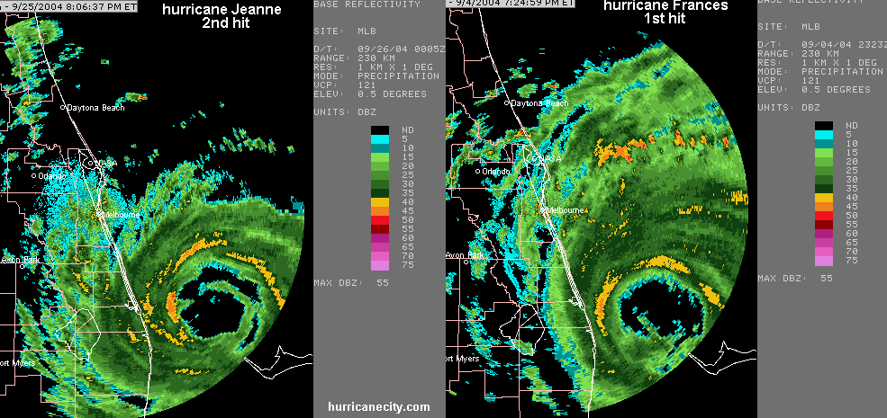
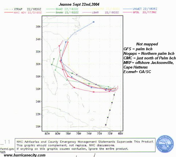
Hurricane Jeanne came ashore just north of Palm Beach County with winds of 115 to 120mph. On the evening of September 26th, 2004 Hurricane Jeanne made landfall approaching the Florida coastline from the east. The highest wind gusts may have occurred near Melbourne, but it is doubtful that major hurricane force winds affected the Treasure Coast except for a few gusts. The image above shows Hurricanes Frances & Jeanne side by side with incredible similarities. Hurricane Frances made landfall on September 5th, 3 weeks earlier with winds of approximately 105mph and looking at the picture above indicates very similar hurricanes. Hurricane Jeanne had a strange course towards Florida by brushing near Hispaniola before turning north & northeast away from Florida. The center of Jeanne moved across Puerto Rico, then over the Mona Passage and inland at the eastern tip of the Dominican Republic. Jeanne was a hurricane with 70 knot winds while over the Mona Passage and during the Dominican Republic landfall, but then weakened over the rough terrain of Hispaniola. While brushing Hispaniola in a very weakened state it almost completely dissipated. Jeanne dumped very heavy rain in Haiti. Mudslides killed an estimated 3,000 plus in northern sections of Haiti, mostly in the city of Gonaives. Jeanne traveled north near the eastern Bahamas and made a loop northeast of the Bahamas. Being steered by a persistent high pressure ridge North of Jeanne caused her to move nearly due west. On September 25th the center moved over Abaco Island and then Grand Bahama Island in the northern Bahamas with 125mph winds. Below the tropical models did a horrible job predicting Hurricane Jeanne's eventual path.


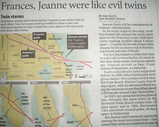
Looking at the picture above shows how close these two hurricanes came ashore. Although Frances was a bit weaker, she was a larger hurricane with higher winds reaching further south & north. Jeanne was slightly better organized at landfall with higher winds felt in the same areas affected by Frances. Frances caused a lot of tree damage, but Jeanne caused more structural damage in the direct impact areas. The most damaged areas found by HurricaneCity.com was in Martin & St. Lucie counties. Most observed damage was roof shingles missing, many signs destroyed, chunks of roofs blown off and many power lines down. One observed shopping mall has aluminum/steel roofs peeled & blown clean off. (yes that's right the same steel roofs that people say hold up well in hurricanes)

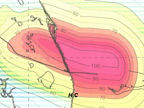
The initials H.C. above indicate our location here at HurricaneCity.com. Our high gust measured during Hurricane Jeanne was 71mph in the very early morning hours of September 26th. This map above from NOAA's Hurricane Research Division confirms our measurements. During the height of the storm we had our hurricane warning show that night streaming as landfall was taking place. We lost power as the highest winds were moving in. With the generator failing, the broadcast was terminated.
Hurricane Jeanne statistics:
- Northern Bahamas: Gusts to 125mph
- Haiti: Thousands killed by mudslides. Hundreds of thousands homeless.
- Fort Pierce, Florida: High wind gust of 111 knots.
- Only 3 dead in Florida but over 3,000 overall.
- Born September 13th and died September 27th in merging with a front.
- Lowest pressure observed 950mb, Florida, 120mph
- 6 foot storm surge approximately, Florida