By: Jim Williams Oct,2018
I took an interest in hurricanes in the mid 1970s and since then have been in or near the core of 10 hurricanes in which half were major. Those were Hurricanes Andrew cat 5 to my south in 1992, Jeanne 2004 cat 3 just to my north I was in core, Matthew 2016 cat 3 just to my east in New Smyrna bch,FL in western eye wall , Irma 2017 cat 4-3 just to my S.W and Hurricane Michael this year where I was in the eye . On a side note hurricane Wilma 2005 passed right over my home with the eye passing over as a cat 2 after hitting S.W Fl as a cat 3. The reason for pointing these out is to let you know I have been in high winds before and that may have helped prepared me for what I was about to go through.
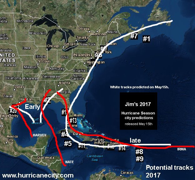
Since 1998 we have provided live hurricane coverage at hurricanecity.com for most major hurricanes hitting the Caribbean and for most other hurricanes hitting the U.S Mainland here is our list of video archives. We have always tried to show live webcams,chaser video,local news and stats as a hurricane is hitting. This process has become increasingly difficult as the years have passed due to copyright concerns, loss of internet streams, cams being taken offline and simply not very good reporting as hurricanes hit. Case in point the Weather Channel coverage consist’s of multiple reporters on scene with most if not all of them outside of the core of highest winds. They often show their main stars leaning in to the wind or getting blown over which can happen in category one conditions when the hurricane itself is major. Quite a few storm chasers used to participate in our coverage but have chosen to sell their video rather than share it live. This sets the stage for my intercept of Hurricane Michael in Panama City,Florida October 10th,2018.
Earlier this season Hurricane Florence was headed towards North Carolina and I wanted in the worst way to be there covering it as it moved onshore. I lost a close friend and had to attend her funeral the weekend prior to Florence hitting. The time left over would not have allowed me to set up properly in time to do an effective job covering Florence. At the time I thought “well usually (except for last year) there is one big one for the U.S (or none) and that is it” , but nearly one month later things would change as Hurricane Michael would head for the Florida panhandle.

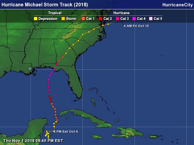
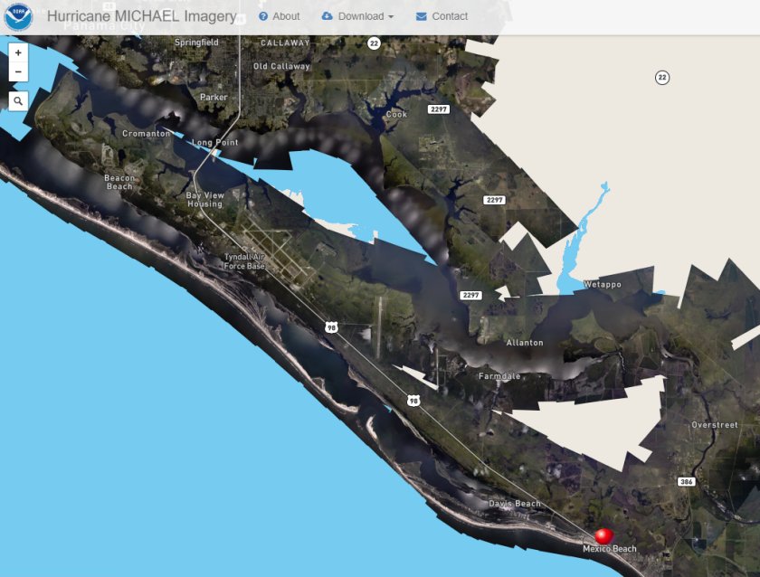
So now that you know why I went in to the teeth of the tiger ,let me tell you what is was like the day before Michael hit. Oct 9th I traveled though Panacea,Apalachicola,Port Saint Joe & Mexico beach before settling in Callaway near Tyndall Air force base. At this time winds along the coast were brisk but probably not much over tropical storm force minimum of 40 mph. While passing through Apalachicola I noticed some small vessels and docks sunk beneath the rising tides. Traffic was light mainly outgoing but hwy 98 was passable late in the afternoon in both directions. It did not appear at this time that any homes were being inundated even if they were they were on stilts. My thoughts were NO–NO & NO for deployment to this area for Michael or any other storm as getting away from the surge would be problematic. Honestly the entire big bend Florida area scares the hell out of me when it comes to water inundation as low lying and vulnerable to huge surge. From just east of Panacea on Apalachee Bay all the way to my target area most homes were boarded up & people were getting out. Even fuel was scarce most stations with yellow caution tape on pumps as out of gas. I found one isolated gas station south of Panacea that still had fuel so I topped off the truck which ended up being my smartest decision the entire trip. As I was leaving Apalachicola it was as if I was saying goodbye to all of those structures along the coast but luckily most survived due to Michael making landfall further north. With a full tank of gas which is enough to get 300 miles I continued west towards Port Saint Joe. I had tentative plans to stay at the mainstay suites in Port St Joe but after viewing the property it appeared there were too many trees and the hotel was isolated from the downtown areas so I decided to head north. It turns out that the hotel had very little damage & many of the surrounding trees were left standing possibly due to Michael hitting further north.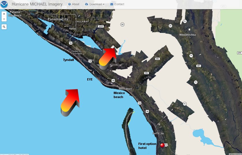
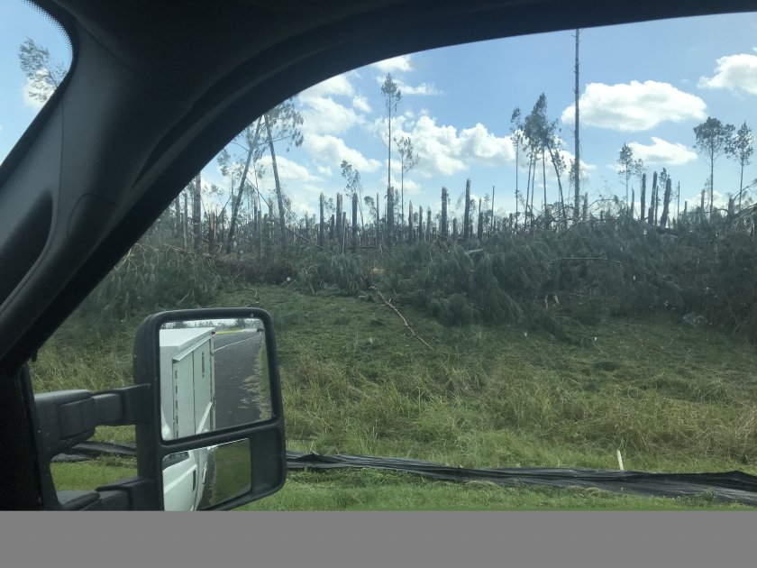
Each of these towns leading towards Panama City are separated by long stretches of wooded areas along hwy 98. As I entered Mexico beach from the south the tree canopy was suddenly absent with long stretches of exposed beaches. Small hotels & larger condos sprinkle the shoreline with restaurants, small stores & residential homes on the east side of hwy 98. Most structures on the coast looked well built even though they were mostly wood framed. Some condos looked to be CBS but again with a potential major hurricane on the way the place did not look safe at all. The few small hotels were not even an option as they were boarded up & wisely abandoned. If my truck were to survive, would I want to sleep in it for three days? NO. This ended up being ground zero right front quadrant of Hurricane Michael and every conceivable option for lodging ended up being destroyed. The town looked mostly abandoned a few people & cars driving around but very quiet. At the north end of Mexico Beach I was going to set my remote camera up on a canal facing the Gulf which in hind site would have been epic and could have caught the southern portion of the eye but retrieval would be difficult getting back in to this area from the north.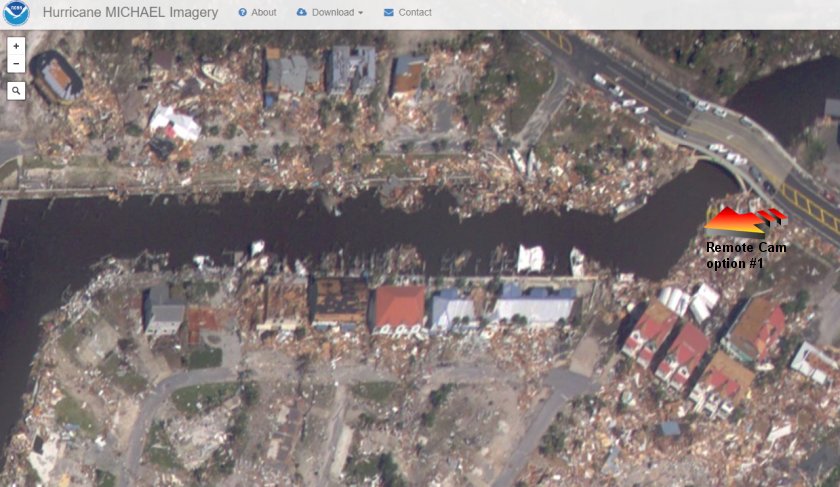
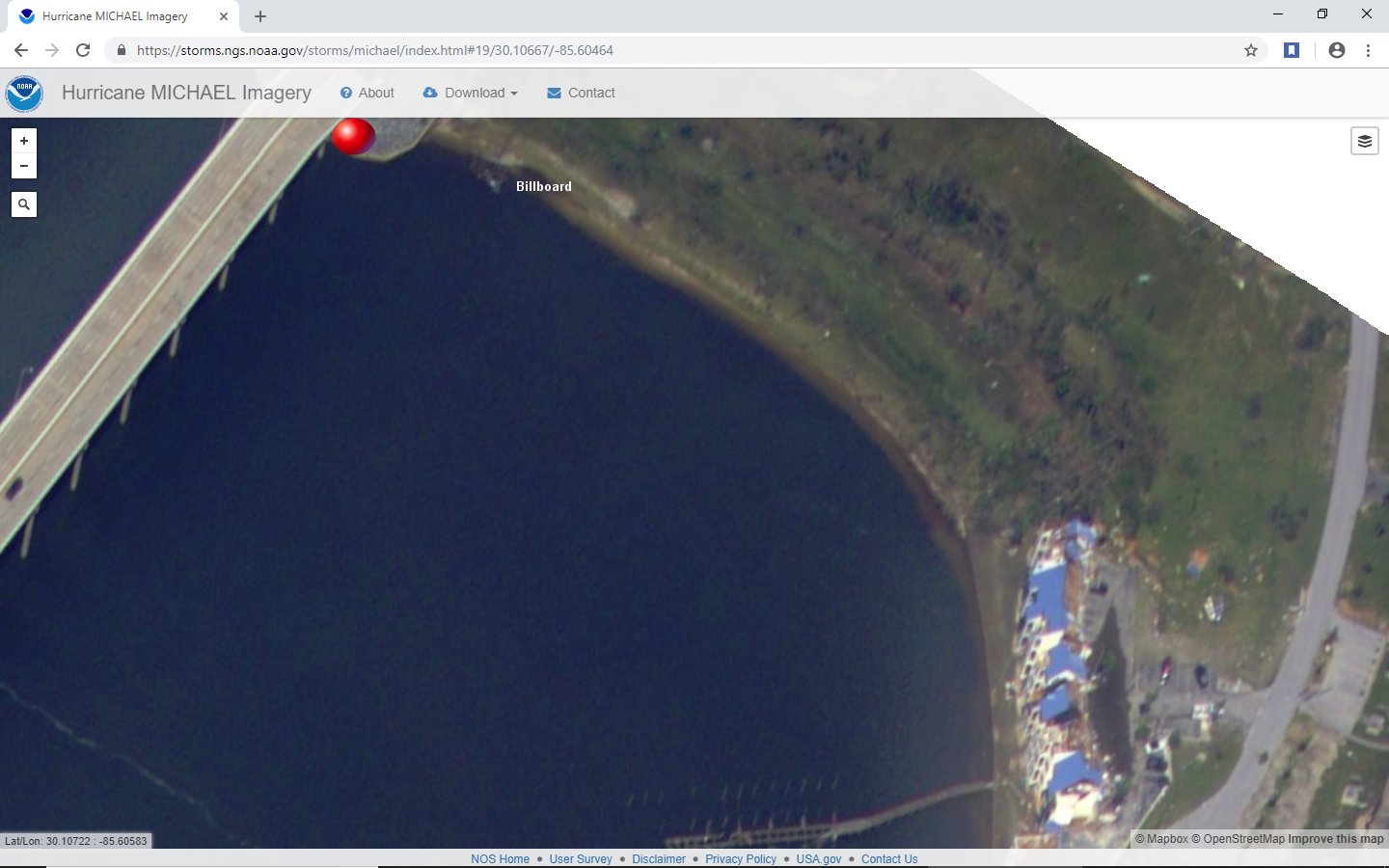
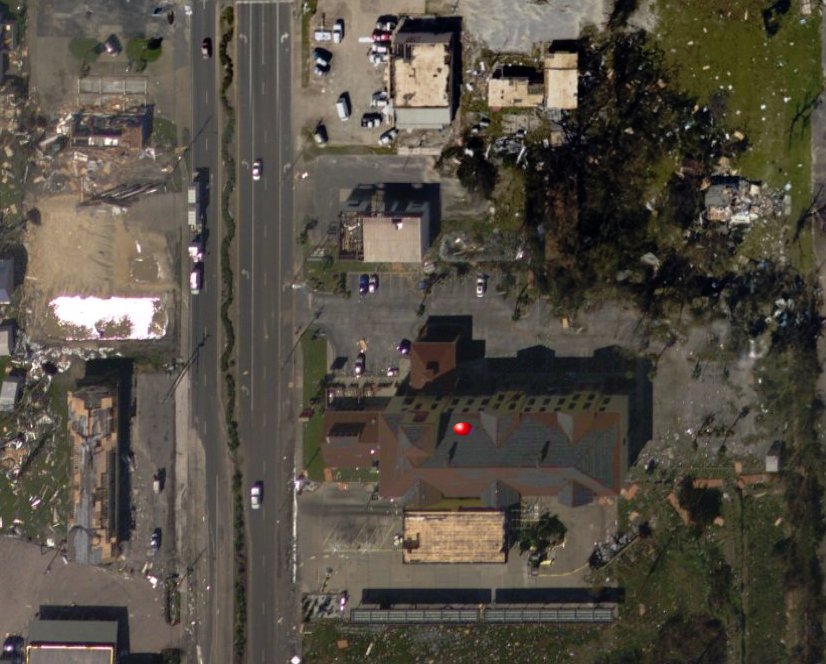
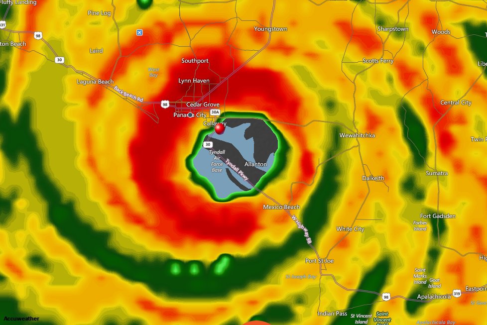
After deciding Mexico beach was probably not going to be an option I headed further north through another stretch of woods several miles to reach Tyndall Air Force Base. Several large guarded entry ways for military personnel only stretch all the way north to the Dupont bridge leading in to Callaway. Again this area very quiet as the bases were probably left with skeleton crews. There are no hotels in this stretch of hwy 98 which forced me in to Callaway but not before I found a good position to mount the remote camera where I could retrieve it before leaving. Notice the photo below the bill board crashed to the ground & the condo roofs took a beating.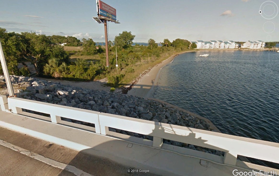
After driving north on Tyndall blvd it appeared the closest hotel to the coast was the Comfort Suites. I investigated several other hotels just to the north but they did not seem as sturdy as the comfort suites and I ended up being right as they sustained significant damage in comparison. The photo below shows surrounding heavy damage but the hotel lost just shingles, some windows and part of the front canopy. The striking thing to me was that no one seemed real concerned about was was coming,even the clerk at the front desk did not seem to be concerned. I asked about a generator,are the windows thick?, do you have a room on the second floor in case of flooding?, do you have a room facing north figuring at check in the winds would be mostly south & southwest all questions seemed awkward for her.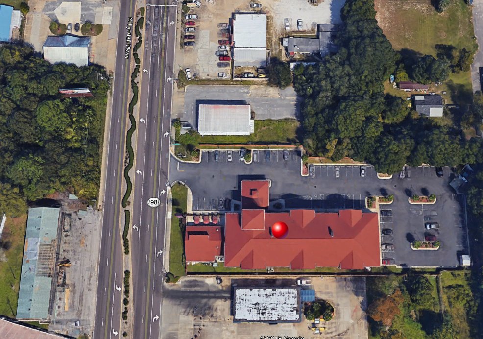
Eve of Hurricane Michael we broadcast live on Facebook and Periscope at 8:00PM warning of the danger that is coming. Starting from the beginning of the video the threat is clear even inland is in danger.
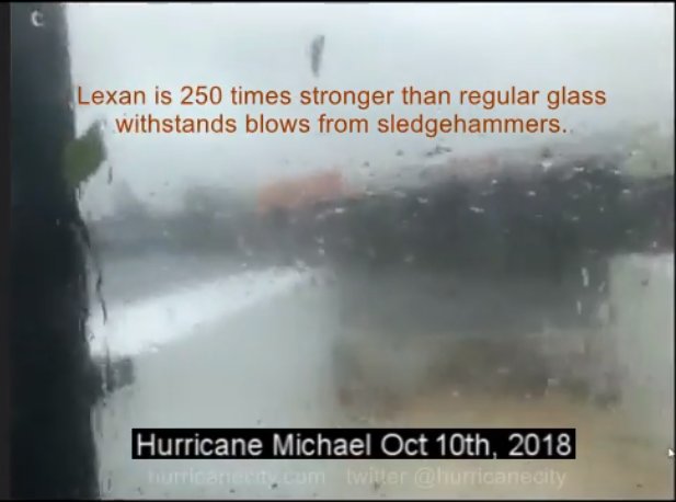
Surprisingly the morning of Michael the hotel still had it’s continental breakfast & room service was operating as if everything was normal. I took advantage of the breakfast but my stomach was in knots so I nibbled & grabbed some bananas to go. I work outdoors in harsh conditions year round and have trained myself not to eat too much food or drink too much water as it will come back to haunt you in extreme conditions as bathrooms are not an option. This was yet another good choice as food was scarce in the aftermath along with power or running water. I waited until just before noon for the core to arrive which is a tradition at hurricanecity.com for all hurricane landfalls no broadcast until the worst arrives. Before leaving I made one final call to my co host Bill Phillips questioning if I should head out at all considering we now have a borderline category 5 on our doorstep. We talked about maybe staying under the overhang in front of the hotel but after driving underneath realized the view was not very good. Furthermore the wind would have been pushing straight in on the overhang putting the truck at risk of loosing the front window as the winds would now be East and N.E rather than the anticipated southerly winds. I decided at that moment to head south on Tyndall blvd in order find an open lot to ride it out. Just about a half mile south of the hotel I find a parking lot with a Texaco station which believe it or not was already mangled from either strong straight line winds or a tornado. As the winds at this point were mainly out of the east probably cat one, I decided to face the Texaco station west with the back of the truck in to the wind to be shielded by my lexan protective glass.
As time went by the barometric pressure was dropping like a rock and the winds were picking up gusting to 100mph. As the pressure dropped to around 940mb all hell broke loose with he winds accelerating in what I like to call jet airplane mode. Major hurricane force winds were buffeting the truck with debris slamming into the lexan glass & the back of the truck. This lasted for maybe 15 minutes but it seemed like an hour to me. At one point just before the eye arrives the winds are so strong no matter what direction I faced the air was filled with debris as if a tornado was hitting seen in short version below.
Meanwhile the remote camera on the east bay was getting annihilated . The clips in the videos speaks for the violent conditions the camera was enduring which operated through most of the storm. White out conditions pretty much prevented any real good video so next time it will be mounted closer to nearby objects.
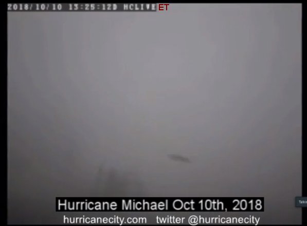
Finally the eye arrives and I get out to survey the damage est pressure 923mb as my last fix was 924.8 while still coming out of the eyewall. I was too involved with damage assessment to check it when the calmest period was over me so I used nearby chasers readings.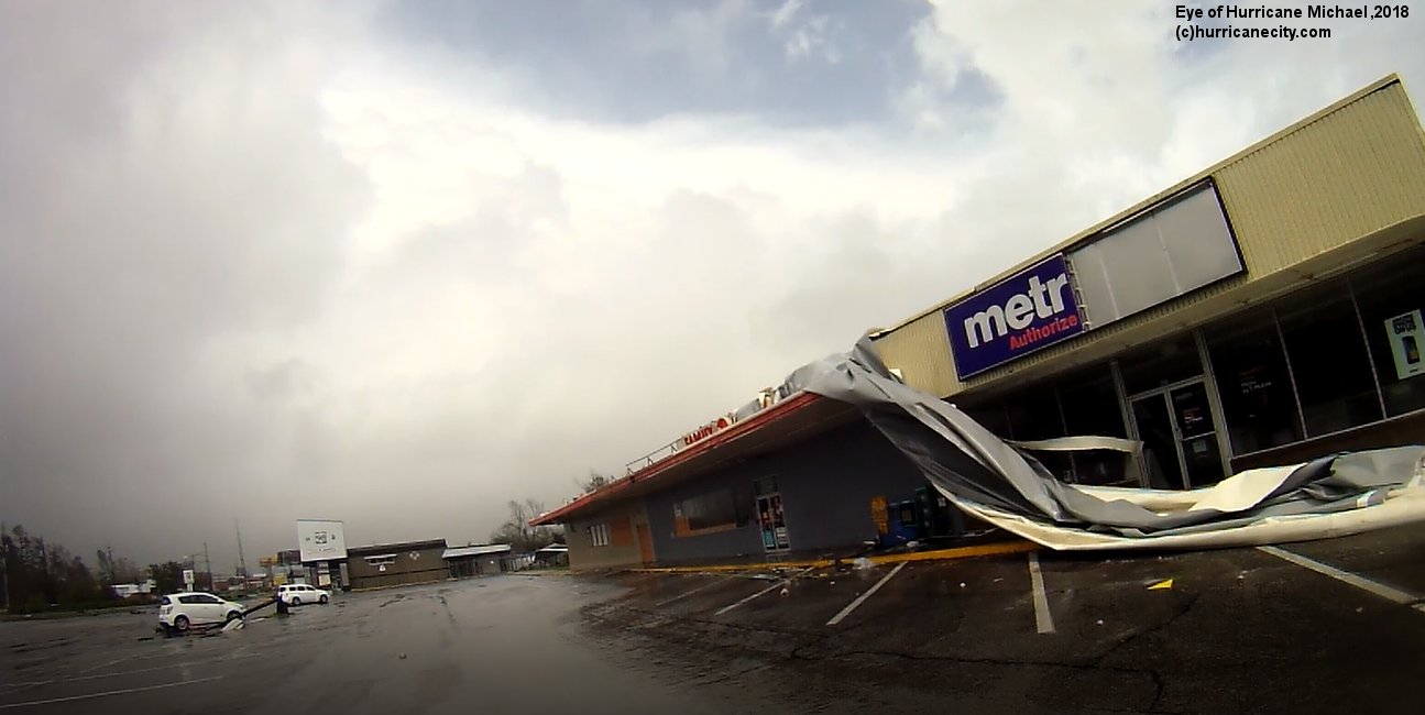
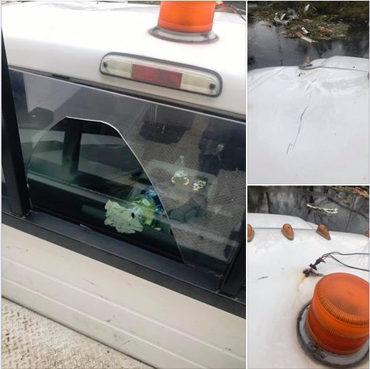
The truck took a hard hit as the paint peeled off the rear bumper with several dings all over the truck but the worst was yet to come (eye survey below).
As the back side of Michael was approaching I decided to head further south to another open parking lot away from power lines,trees and poles as I knew the winds would be shifting out of the North. Just about every store front window protected by plywood was blown out and the worst was yet to come. As the winds shifted the truck was getting pelted with larger debris than before and shaking more violently. At one point a large children’s playground set was being pushed across the parking lot as the cinder block building to my north blew open pushing items out of the side of the building. Suddenly a large object hit the top of the truck ripping the light bar off & flung it in to the parking lot. At this point I lost my internet connection with Bill & the stream was lost as the worst conditions were upon me. This was a lonely feeling as the truck was getting nailed ,then it happened the lexan glass broke .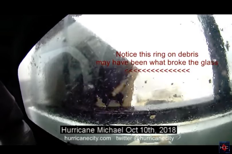
Watch closely in the clip below as the object pictured above about the same size as the hole to the right is stuck against the lexan glass, this could have been the culprit.
Luckily our internet outage only lasted for 15 minutes and we were back on air. For another 15 minutes the winds were well over 100 mph as I continued positioning the truck backing in to the wind. Finally things calmed down & the pressure was rapidly rising as I slowly made my way around downed power lines, trees and power poles to get back to the remote camera. The further south I got towards the camera the more damage their was with more people needing help. You see my truck looks like a city vehicle so obviously people thought I was the first arrival of help. I had several conversations with people explaining injuries needing communications in which 911 was down at the time. People needed to know where shelters were I had limited information and don’t even get me started on how many homeless people were in this area before the hurricane. They all had stories to tell I mean as high as the water rose in that area I cannot even imagine where they escaped to. All I could tell them was that help is on the way as I would later find out huge convoys were headed in.
Altogether these were probably the most dangerous driving conditions I have ever been in as the truck clearance barely made it underneath hanging power lines. At times I had to travel through grass and muddy areas nearly getting stuck but finally made it to retrieve the camera. Upon arriving back at the hotel I noticed about a dozen windows blown out on the north side of the building but luckily my room window was intact. After surveying the hotel it appeared that no staff was present but the main lobby was leaking badly. People were wondering around like zombies taking in all the views of damage with disbelief. Obviously power was out but so was water I could not flush the toilet or run water out of the faucet “oh I am so glad I did not eat”. I did however turn the AC down to its coldest setting right before Michael hit which allowed the cool air to stay in the room so I could get a decent nights sleep. At least that was the plan but all I could hear all night was the sound of wind in my head like white noise replaying the worst of Hurricane Michael. Not to mention with no ACs running you hear every foot step & voice in the hall ways.
After tossing and turning all night I left the hotel around 9AM still no one at the front desk. The hotel looked like it was stuck in time with everything disheveled and people wondering around not knowing what to do or where to go. One woman frantically came up to the truck asking if I knew where any shelters were. She had a disabled child and two elderly people who needed medical attention. Thanks to my buddy Gregg Gibbs in emergency management as he was able to give me some addresses. As I headed north the view of the damage was tremendous with scenes like this Waffle house everywhere. Sadly most of the TV & radio stations were knocked off air. I could only find one AM and one FM station with hurricane information one of them simply looping a press conference, is this the best they can do? PEOPLE NEEDED INFO (FAILURE).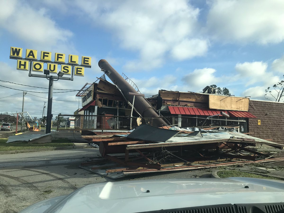
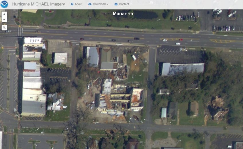
Taking 15th street north towards hwy 231 not one building did not have significant damage. Further north on hwy 231 a reported 139 train cars were flipped over due to the strong winds. As I traveled towards I-10 the damage was still noticeable then I come to find out I-10 is shut down due to tree removal. I decided to take hwy 90 east towards Tallahassee traveling through cities like Marianna where damage was extensive.
This turned out not to be a good decision as traffic was flowing so slow it was mostly at a complete stop. I got back on I-10 west of Tallahassee only to run in to more gridlock as road crews were clearing trees it was as if Michael was a gigantic weed eater through the forest.
It ended up taking me nearly all available daylight just to get to Tallahassee in which many were still without power. After getting back on the peninsula I tried getting a hotel room after being exhausted from driving . Every hotel I tried was booked with power crews,insurance adjusters,tree crews and first responders coming up from the south but finally found a room near Gainesville. All available help was needed so I was not disappointed but before I crashed for the night I stopped in for a bite to eat at the Waffle House. I showed the crew the photos of the Waffle house crushed in Callaway seen above and they seemed a bit surprised making me wonder if the word got out of how bad it really was in these hit areas. So after getting back to my home base Delray Beach I took my truck to Prospect Plastics & Terry’s Toppers to show them what happened and how this can be addressed. Below is what the truck looked like immediately after Hurricane Michael, even one of the running lights got destroyed.
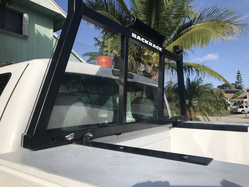
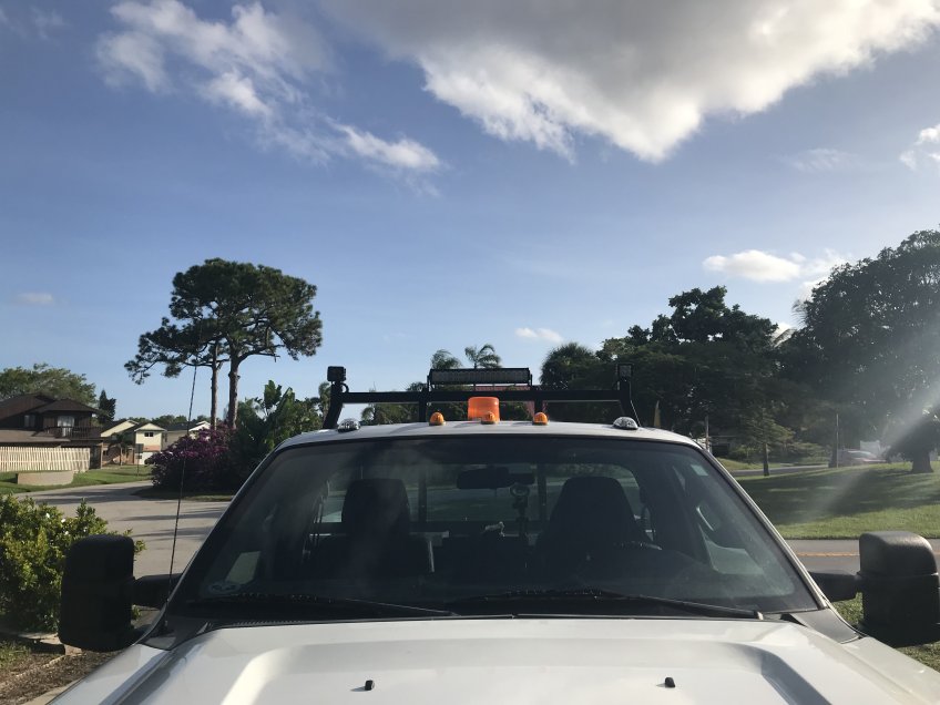
They suggested thicker Lexan when I said “I thought this was unbreakable?” with shrugged shoulders they said “nothing is totally indestructible” so I upped the thickness to 3/8 from 1/4 anything thicker would yellow from the sun. New matching running lights were installed on both ends and the hole in the roof from the light bar was patched. They mounted the new lights on the backrack eliminating the roof of the truck from any future damage.
Overall I would rate this as a successful intercept with some minor adjustments needed for the next hurricane. I will do my best next time to interact more with the audience on periscope and to at least respond to the questions people were asking. I may do more interviews with victims and show more close up damage. I will take more digital video in the eye to examine the structure of the clouds and movement. I will install an external Microphone to capture the sound of the wind which you could not hear that well on the live feeds. I feel bad for the people impacted by Hurricane Michael as it will take a long time to recover . It is quite different to take the hit & get out versus having to stay in the area & deal with one problem after the next for months if not years. If possible we’ll see you in the next one and I promise to do my best not to disappoint, please spread the word and donate if possible,this isn’t cheap.Please donate any amount helps Thank you…..Jim Williams